Your Cart is Empty


White Mountain Trail doesn't get the same hype as some of Big Bear's gnarlier routes, and that's exactly why I like it. Last summer, I ran it with friends who were newer to off-roading. Everyone made it through without drama, got killer views of the San Bernardino Mountains and the Mojave Desert, and left wanting more. That's White Mountain Trail in a nutshell. The White Mountain area offers some of the best technical off-roading in Southern California.
Looking for other Big Bear trails? Check out our Big Bear Off-Road Trail Guide
You'll find the White Mountain Trail (3N17) in the Big Bear area backcountry, running through forest corridors and opening up to scenic ridgeline sections with views that'll make you stop for photos. The trail sits between 7,000 and 8,027 feet in elevation, connecting the Holcomb Valley area to the desert-facing slopes through about 8 miles of beautiful scenery and terrain. Perfect for testing a new build or introducing friends to overlanding, provided they are ready for a few technical challenges.
White Mountain Trail follows old logging and mining routes from the 1800s, when these roads moved supplies through the San Bernardino National Forest. The region has a rich history of resource extraction. The Forest Service maintains it as a "Most Difficult" high clearance vehicle route in this national forest area, meaning it's legal for 4x4s but will definitely keep tourists far away (sometimes hard to do in Big Bear).
The trail typically opens by late May or late June after spring snowmelt clears the area. You can run it through winter months if the weather cooperates, but winter conditions are usually met with a trail closure. Difficulty stays in the 5/10 to 7/10 range (Black Diamond) largely due to the "Gatekeeper" obstacle and loose, steep climbs. Total elevation gain is significant, but spread out, so you're mostly focused on traction with shorter spurts of elevation climbs.
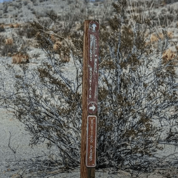
The White Mountain Trail (3N17) can be accessed from several points, but the technical "rough road" entrance most people talk about is found on the western side.
This is the route shown in the most popular trail reports. It starts where the forest meets the high desert.
If you are already in Holcomb Valley, you can connect to White Mountain from the south.
The trail also intersects with 3N11, which allows you to exit toward the desert or loop back toward the 3N16 area. This is a common "bail-out" or loop-completion point after cresting the summit.
The White Mountain Trail starts with a bang if you enter from Holcomb (the Gatekeeper), then settles into a rhythm. The first sections require careful wheel placement on jagged rocks. Then the trail climbs into the White Mountains' rockier terrain and you start paying attention to your line choice. The ride remains technical throughout the ridge.
Plan on 2 to 3 hours to run the main section if conditions are dry. Add time if you're newer or the weather's been wet. Rain and snowmelt turn these rocky climbs into slippery challenges fast.
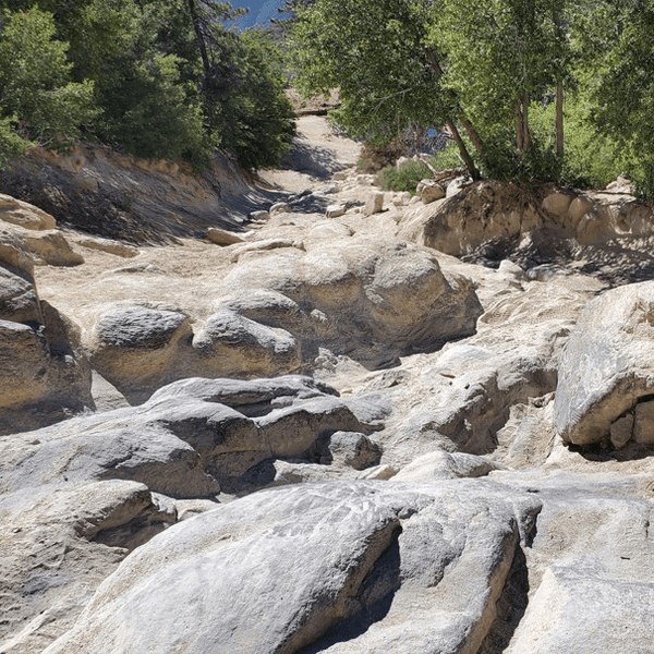
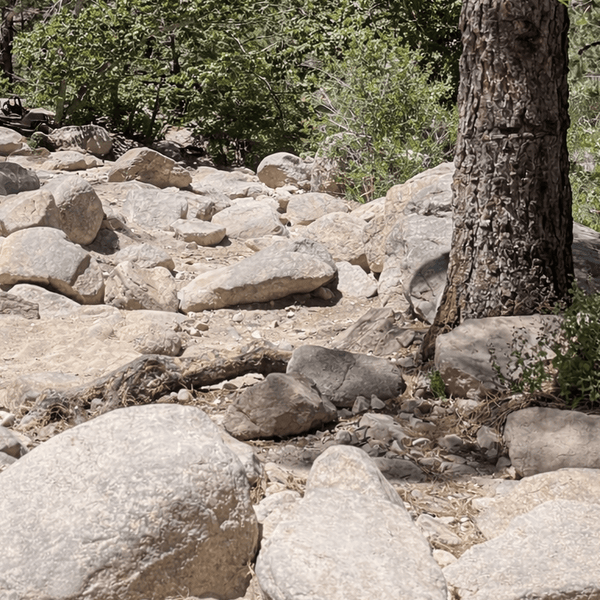
Surface conditions change constantly. Decomposed granite that's grippy, then exposed rock that makes you think about your line. Ridgeline sections are mostly hardpack with scattered loose "baseball" rocks. Forest corridor sections tend to be narrower, with tree roots and dense brush, including pine branches.
Trail width varies quite a bit. Open ridgeline areas give you room to pick different lines. Forest sections tighten up, and trees will scratch your paint if you're not careful.
Pick your trailhead (West Entrance via Polique Canyon is an option), run White Mountain Trail to the summit, then either backtrack or continue down the north face if you're feeling adventurous or if you want to descent on Suicide Hill. If you want challenging first then relaxing later, start on the other end of 3n17.
The trail takes about 3 to 4 hours, including stops for photos. A fine way to enjoy a half-day trip.
Who it's for: Intermediate drivers looking for a half-day adventure. Good for testing a new vehicle setup or bringing along friends ready to step up from fire roads.
Use White Mountain Trail to connect the Holcomb Valley area to the desert trails or loop back to Gold Mountain.
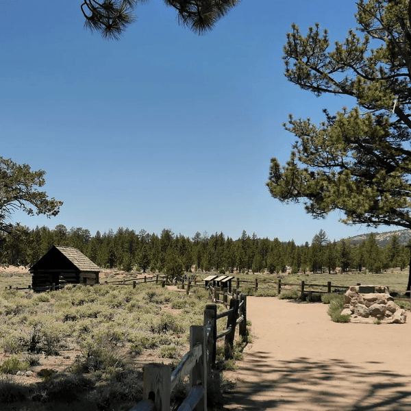
You can explore historic sites in Holcomb Valley, then head up for the technical challenge. Stop at scenic overlook points along the way.
Who it's for: Groups with mixed experience levels. Overlanders planning a weekend trip. Budget 5 to 7 hours depending on side trips.
Connect White Mountain Trail with other Big Bear trails like Gold Mountain and John Bull into a 50-plus mile loop. This entire loop requires solid planning and navigation skills. Two vehicles minimum for safety. Who it's for: Advanced groups looking for a proper backcountry challenge. Plan on 8 to 10 hours of trail time.
|
Section |
What to Expect |
Tips |
|
The Gatekeeper |
Steep, jagged rocky entrance at the start |
This is the "filter." If you struggle here, turn back. |
|
Suicide Hill |
A long, loose, steep hill with an off-camber ledge |
Use lockers if you have them. Momentum is key but dangerous. |
|
Loose Shale Climbs |
"Marbles on rock" traction surface |
Distinct from the solid granite found on other local trails. Requires ultra-low tire pressure (15 PSI). |
|
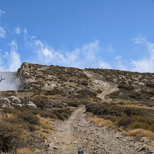
The Summit Ridge |
360-degree views of Mojave & Big Bear |
The wind here is often 20mph+ stronger than in the valley. Secure your doors. |
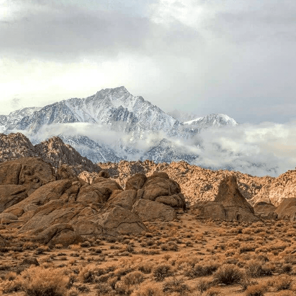
The ridgeline sections hit around the midpoint. On clear days the view stretches for miles. Big Bear Lake to the south, the Mojave Desert to the north. Pull over at these high points to soak in the great views.

Rock-strewn climbs pop up throughout. Basketball-sized rocks on slopes with just enough angle to get your attention. Air down to 18-20 PSI and these become manageable.
Forest corridors narrow down with pines closing in. Can be muddy after rain. If you meet oncoming traffic, the downhill vehicle backs up. Stop when you need to let others through safely.
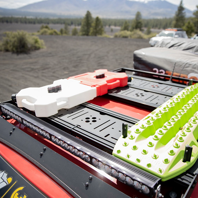
Here's what you need to do White Mountain Trail comfortably:
I've done it in a barely modded Tacoma with 32s. Pick careful lines, and you're fine. Most guys run something similar and stay comfortable.
For more confidence and comfort:
This setup turns White Mountain Trail from "paying attention" to "having fun." Good all-terrain tires from companies like BFGoodrich, Falken, or Nitto make a huge difference in loose rock and comfort.
The best views come into play when you reach the ridgeline. The San Bernardino Mountains stretch out everywhere. Big Bear Lake to the south, the desert floor to the north. On clear days you can see San Gorgonio Peak. The view from this point is worth the entire ride.
Wildlife's common throughout the mountains. You are likely to see deer, especially in the mornings and afternoons. Black bears live here too. Secure your food and trash.
Forest sections show old logging stumps from over a century ago. Some flat spots were loading areas where logs got staged before moving down the mountains.
Dispersed camping is allowed throughout San Bernardino National Forest on public land. Stay at least 200 feet from water sources. Use existing fire rings at each site (check fire restrictions!). Pack out everything. Holcomb Valley has the best dispersed camping near White Mountain Trail. The area sees plenty of visitors during peak season.
Big Bear has several Forest Service campgrounds within 20 minutes of the trailheads. These fill up fast on summer weekends, so book ahead. The area sees mountain bikers, hikers, and ATV riders enjoying the recreation opportunities. Be cool to everyone and yield to non-motorized traffic like hikers on shared routes.
The San Bernardino National Forest map shows White Mountain Trail (3N17) and all legal routes in the area with proper access points. Download it from the Forest Service website or grab one at Big Bear Discovery Center.
For GPS, Gaia GPS and OnX Offroad work great. Download offline maps before you go since cell service drops to nothing on the trail. The area is open from July through September, with the best conditions. Many visitors continue to explore through late fall.
Call Big Bear Discovery Center at (909) 382-2790 for current conditions and closures.
White Mountain Trail hits a sweet spot in the Big Bear area. It's challenging enough to feel like a real adventure through the San Bernardino Mountains but accessible enough that you're not risking your rig on every section. The scenic ridgeline views and technical variety make the trip worth it without beating you up.
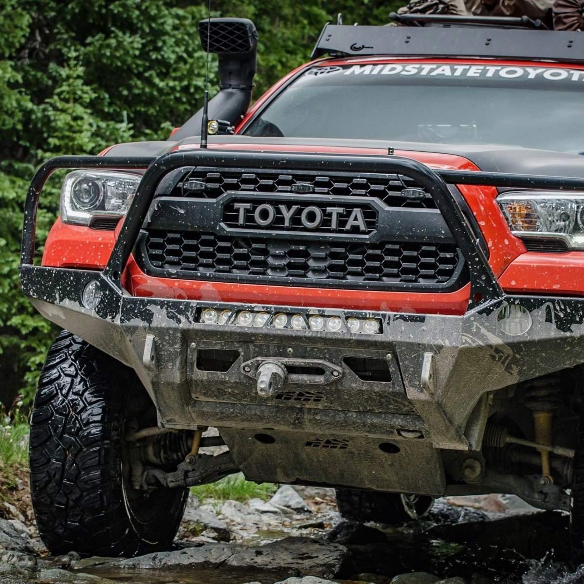
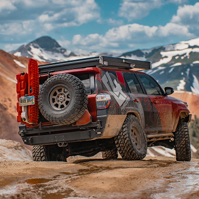
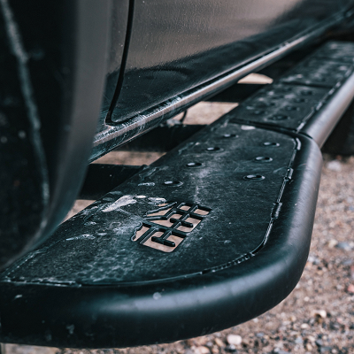
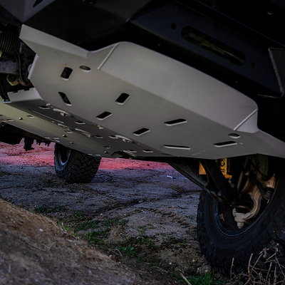
Before you head out, make sure your rig is properly equipped. At Truck Brigade, we specialize in outfitting 4x4 vehicles like Tacomas, 4Runners, Jeeps, whatever you have, with exactly what you need for Big Bear trails, and any trail for that matter. Whether you're looking to add rock sliders, install lift kits, or equip your rig with recovery gear, we've got you covered with premium brands like King, Icon, Bilstein, and BFGoodrich.
Visit truckbrigade.com to explore our catalog and get your rig dialed in for White Mountain Trail and every other adventure waiting in the mountains.
Comments will be approved before showing up.