Your Cart is Empty


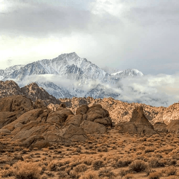
The Mojave Road is a 138-mile journey following ancient Native American trade routes later used by Spanish explorers and the US Army. This legendary desert route crosses California's most remote terrain through the Mojave Trails National Monument to Barstow.
The route sits within a stunning mosaic of protected landscapes. The 1.6 million acres of Mojave Trails National Monument, designated in 2016, preserves ancient lava flows, rugged mountain ranges, and best preserved sites of World War II era military training. Combined with national monument lands and Bureau of Land Management holdings, this creates one of the longest remaining undeveloped stretches of desert wilderness in Southern California.
The terrain combines virtually every desert challenge. You'll cross Soda Dry Lake's hard-packed surface, navigate deep sand around spectacular sand dunes near Kelso, ford water crossings where the Mojave River surfaces, climb rocky sections near historic springs, and traverse open desert. Elevations range from 500 feet to over 5,000 feet, creating dramatic climate variations.
Most people complete the Mojave Road over 2-4 days. The remoteness within this national monument landscape is genuine. Cell service is nonexistent. Nearest services can be 50+ miles away. Self-sufficiency isn't optional on this trail.
Looking for Other Southern California Off-Road Trails? Check out our So-Cal Off-Road Trail Guide
The difficulty varies by segment. Overall, this rates as moderate to hard multi-day adventure requiring solid 4WD skills and thorough preparation for Mojave off road trails conditions.
Easy Segments: Stock high-clearance vehicles handle portions like Soda Lake crossings showcasing Mojave Trails landscape without extreme technical challenges.
Moderate Segments: 4WD required with all-terrain tires and 33-inch minimum. Sections near historic springs feature embedded rocks, moderate sand, and climbs requiring careful line choice.
Hard Segments: Water crossings and deep sand demand 35+ inch tires, recovery gear, and advanced skills. These can damage unprepared vehicles in extremely remote locations.
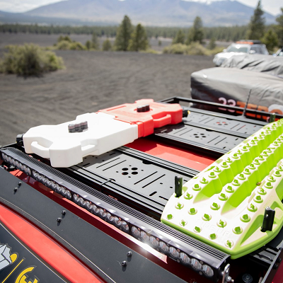
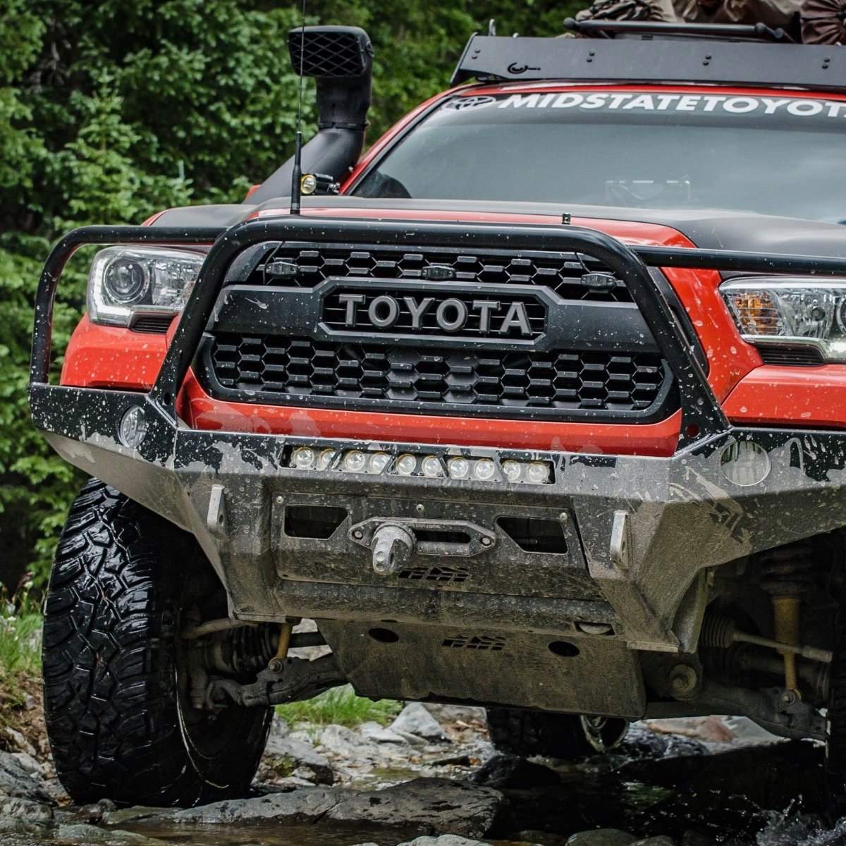
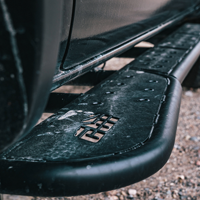
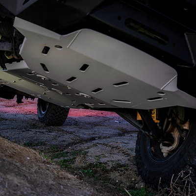
Essential Modifications: Minimum 33-inch all-terrain tires provide clearance and sand flotation. Full skid plates covering oil pan, transfer case, and fuel tank essential. Rock sliders protect rocker panels. Upgraded suspension handles sustained washboard.
Required Recovery Gear: You will get stuck in sand. Maxtrax or traction boards non-negotiable. Full recovery kit including straps, soft shackles, shovel, and hi-lift jack. Winch highly recommended for technical sections.
Navigation: GPS with downloaded offline maps essential. The route crosses numerous trails and mining roads in the national monument area. Paper maps as backup. Satellite communicator provides emergency communication.
Water and Supplies: Carry at least one gallon of water per person per day, plus extra. Historic springs are NOT reliable water sources. Bring more food than needed. Spare parts including belts, hoses, fluids, fuses. Extra fuel in jerry cans as gas stations are far apart.
Best Season: October through April offers optimal conditions with temperatures in 60s-80s. Spring brings wildflowers. Winter nights drop to 30s. Summer (May-September) is dangerous with temperatures exceeding 115°F.
Weather Hazards: Flash floods are serious threat. Never camp in washes. Desert storms can make crossings impassable and create deadly floods through canyons.
Permits: Sections cross Mojave National Preserve and Mojave Trails National Monument where dispersed camping regulations apply. Some cultural resources and preserved sites have specific access rules. Check current regulations as rules change.
Emergency Preparedness: Nearest hospitals are in Barstow, Needles, or Las Vegas area, potentially hours away. Self-rescue capability critical. Travel with at least two vehicles when possible.
|
Trail |
Difficulty |
Miles |
Typical Time |
Highlights |
Best Season |
Suggested Rig |
|
Black Canyon Rd to Cedar Canyon Rd |
Easy |
~15 |
Half-day |
Hole-in-the-Wall formations, Rings Trail, Rock Spring |
Fall-Spring |
Stock 4WD/SUV |
|
Kelso Dunes Access |
Easy |
4 |
1-2 hours |
Tallest dunes in Mojave, singing sand |
Fall-Spring |
2WD acceptable |
|
Mojave Road (complete) |
Moderate |
138 |
2-4 days |
Historic route, springs, Afton Canyon |
Fall-Spring |
33"+ tires, armor |
|
Caruthers Canyon Road |
Moderate |
~10 |
Half-day |
New York Mountains, granite formations, mine |
Fall-Spring |
33"+ tires, high clearance |
|
Aiken Mine Rd to Lava Tube |
Moderate |
~15 |
Half-day |
Cinder cones, lava tube, volcanic landscapes |
Fall-Spring |
High clearance, 4WD |
|
Afton Canyon |
Hard |
~20 |
Full day |
Water crossings, canyon walls, deep sand |
Fall-Spring |
35"+ tires, winch |
|
Macedonia Canyon |
Hard |
~15 |
1-2 days |
Remote backcountry, technical sand, solitude |
Fall-Spring |
35"+ tires, armor |
A scenic route connecting two of the preserve's most interesting geological features, accessible via various preserve roads. This easy trail passes through varied desert terrain with opportunities to explore unique rock formations.
The route links Black Canyon and Cedar Canyon roads through the Mid Hills area. From I-40, exit Essex Road and drive north 10 miles. Turn right at Black Canyon Road and continue 10 miles to Hole-in-the-Wall. The roads are paved until the campground turnoff.
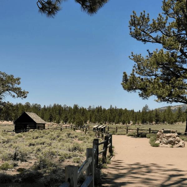
Hole-in-the-Wall features distinctive pockmarked volcanic cliffs. The Rings Loop Trail (1.5 miles) uses metal rings bolted to rock faces for passage through Banshee Canyon. From Hole-in-the-Wall, Cedar Canyon Road runs east for 16 miles to Kelso-Cima Road, passing Rock Spring where a historic rock house and flowing spring offer camping and exploration.

Stock high-clearance vehicles handle this route comfortably. The preserve maintains these roads as 2WD-passable in dry conditions, though high clearance is advisable.
This 4-mile refined dirt road starts from Kelbaker Road (15 miles north of I-40 Exit 78) and leads to the trailhead at the impressive Kelso Dunes. Easy desert roads leading to some of the tallest sand dunes in the Mojave Desert, offering unique landscape photography opportunities.
The Kelso Dunes cover 45 square miles and rise 650 feet above the desert floor. The dunes are composed of light-colored quartz and feldspar sand. The access road has potholes but is passable to 2WD vehicles driving slowly. Vault toilets and parking at the trailhead.

Hiking to the summit is 3 miles round trip through shifting sand. Budget 2-3 hours. The dunes sometimes produce a "singing" or booming sound when surface sand avalanches. Best visited at sunrise or sunset for cooler temperatures and optimal light.
This historic 137.5-mile trail runs from near Needles, California to near Barstow, following the ancient trail used by Native Americans and Spanish expeditions. The route stretches from Beale's Crossing on the Colorado River to Afton Canyon near Barstow, crossing varied desert terrain. Individual sections can be tackled as day trips.
The difficulty varies by segment. Easy sections include Fort Piute to Colorado River (20 miles) and Soda Lake crossings (30 miles). Moderate sections cover Kelso to Fort Piute (30 miles) with rocky roads and sand washes, and Marl Springs to Afton Canyon (40 miles) featuring deep sand. The hard section is Afton Canyon to Soda Lake (20 miles) with mandatory water crossings and the deepest sand.

Most complete the full route over 2-4 days. Cell service is nonexistent. Navigation requires GPS with offline tracks plus paper maps. Key stops include Fort Piute (restored 1867 military outpost), Rock Spring (largest watering hole), Marl Springs (5,000 feet elevation), Soda Dry Lake (vast alkaline surface), and historic Kelso Depot.
Minimum 33-inch tires required. Hard sections demand 35+ tires, armor, winch, and recovery gear. Dispersed camping allowed at historic springs. Afton Canyon Campground ($10/night) offers developed sites near the western entrance.
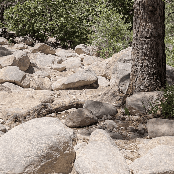
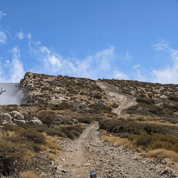
A moderate trail climbing into the New York Mountains via the preserve's road system, offering cooler temperatures and different vegetation zones. Features some rocky sections and provides access to historic mining areas.
From Ivanpah Road, take New York Mountains Road west 5.5 miles to an unsigned junction, continue 2.7 miles north. The canyon sits at 6,000 feet elevation with granite boulder fields, pinyon pine, juniper, and unexpected coastal chaparral species. The trail follows an old mining road through towering rock formations to the abandoned Giant Ledge Mine.

Road conditions include steep grades, embedded rocks, and sandy sections. High clearance essential. The canyon offers primitive camping with shade and solitude. The 2023 York Fire burned through this area, altering vegetation but leaving rock formations spectacular.
4WD vehicle with 33-inch tires and good ground clearance recommended.
An interesting geological trail leading to lava tube formations in the Cinder Cone National Natural Landmark, accessible via preserve roads. Combines moderate off-road driving with unique volcanic features to explore.
From Baker, drive south on Kelbaker Road 19.7 miles to Aiken Mine Road. The route winds through 40 cinder cones and extensive basalt lava flows. At 4.5 miles, a spur road leads to the lava tube. Park at the old corral and hike the rocky approach to the tube entrance. A metal stairway descends into the cave. The tube formed 27,000 years ago and offers cool temperatures and unique formations.

At 7.3 miles, Aiken Mine features steep climbs requiring 4WD. The road alternates between sand, sharp volcanic rock, and washboard. High clearance required. Primitive camping throughout the lava fields. The volcanic cinders are notoriously sharp and can cause flats.
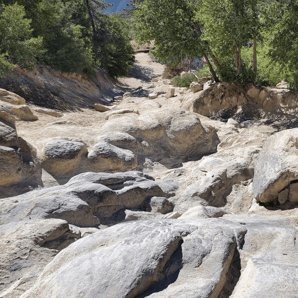
Part of the historic Mojave Road, accessed from I-15 Exit 221 (Afton Road) with a 3.5-mile graded dirt road to the canyon floor. Known as the "Grand Canyon of the Mojave," this trail includes multiple river crossings through spectacular canyon country requiring careful navigation.

The canyon features two mandatory water crossings. Water depth typically 12-18 inches (first crossing) and 18-24 inches (second crossing), but can reach 30-40 inches during spring runoff or after rain. Always scout on foot first. Canyon walls tower 300-600 feet. The trail parallels active railroad tracks requiring extreme caution.
Deep sand sections between Afton Canyon and Soda Lake (Devil's Playground) contain the softest sand in the preserve. Many vehicles get stuck. Air down to 18-20 PSI, maintain momentum without spinning.
35+ inch tires highly recommended. Skid plates essential. Winch recommended. Travel with another vehicle. Afton Canyon Campground near western entrance offers basecamp with vault toilets and established sites.
A remote and challenging canyon trail accessible via the preserve's backcountry road system, requiring excellent navigation skills and self-sufficiency. Features technical rocky sections and requires multiple days for full exploration.

From Kelso-Cima Road, Macedonia Canyon Road heads southeast under railroad tracks (check clearance for roof gear). The route runs smooth initially but becomes seriously deep sand by mile 4.8 entering the canyon. The canyon alternates between open sections and narrow spots with technical rocky sections.
Sustained deep sand tests driving skill and vehicle capability. Remote location means nearest help could be 50+ miles away. Navigation challenges and length make this suitable only for experienced desert explorers. Dispersed camping throughout offers extreme solitude.
Classic 3-Day Route (East to West): Day 1: Start early at Colorado River, navigate to Fort Piute area (mile 23) exploring the historic outpost. Camp near Rock Spring (mile 49) covering roughly 45-50 miles with moderate technical sections. Day 2: Rock Spring to Soda Lake area covering 45-50 miles including passing Kelso area. Consider detour to climb the spectacular sand dunes. Camp west side of Soda Lake or at Afton Canyon Campground if you want established facilities before tackling the technical section. Day 3: Tackle water crossings in morning when fresh and alert. Navigate through the canyon carefully, watching for trains on the railroad tracks. Complete final miles to Barstow.
Aggressive 2-Day Push: Day 1: Colorado River to Kelso area (60-70 miles). Long, demanding day requiring early start. Day 2: Finish remaining miles including technical sections to Barstow. Requires solid skills and no mechanical issues.
Extended 4-Day Exploration: Relaxed pace allows time to explore cultural resources, walk to viewpoints, and handle delays. Day 1: Colorado River to Fort Piute (20-25 miles). Day 2: Fort Piute to Rock Spring (25-30 miles). Day 3: Rock Spring to west Soda Lake (35-40 miles). Day 4: Technical sections and exit to Barstow (25-30 miles).
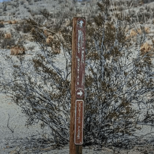
Navigation Resources: Serious preparation required. Download offline GPS tracks from TrailsOffroad, Gaia GPS, or onX Offroad. Dennis Casebier's guide provides detailed descriptions and historical context. BLM maps and Mojave National Preserve maps are essential backup showing designated routes and preserved sites.
Camping: Dispersed camping allowed along most of the route on BLM lands and in designated areas within preserve and monument boundaries. Best spots near historic springs offer shade. Popular camping areas include Rock Spring, Piute Spring, and Marl Springs. Afton Canyon Campground (BLM-managed) near the western approach to the canyon offers vault toilets and established sites, making it excellent basecamp for exploring the canyon section. Always use previously disturbed sites for dispersed camping. Never camp in washes. Some areas have picnic tables at established sites.
Trailhead Access: East (Traditional Start): From Needles, access trailhead near Arizona/California border. This follows historical route direction. West (Alternative): From Barstow, access via I-15 to Afton Road. Some prefer running west-to-east to tackle technical sections first when fresh.
Fuel Planning: No gas stations along the route through the monument. Fill completely before starting. Most vehicles complete on one tank, but carry extra fuel for safety. Nearest fuel from midpoint can be 50+ miles in any direction.
Visitor Information: Mojave National Preserve has visitor centers offering maps, current road conditions, and information about cultural resources. The monument has limited facilities but BLM offices provide information about dispersed camping and designated routes.
Water Crossings at Afton Canyon: Always scout both crossings on foot first. The first crossing is typically shallower (12-18 inches) while the second can be deeper (18-24 inches). During high water periods (spring or after significant rain), depths can reach 30-40 inches. Check for firmest rocky bottom and most gradual entry/exit points. Walk the crossing on your heels to estimate how deep tires will sink. Take your time; rushed crossings lead to stuck vehicles or water intrusion. Stay toward the shallower side of the crossing if depths are concerning.
Railroad Safety: Active freight trains use the tracks through Afton Canyon regularly. Stop, look, and listen before crossing railroad tracks. Never park on or immediately adjacent to tracks.
Sand Driving: Air down to 18-20 PSI for deep sand sections approaching Afton Canyon and in various washes. Maintain momentum without spinning tires. If you bog down, stop immediately. Use traction boards early rather than waiting until buried.
Site Respect: Fort Piute and other preserved sites are irreplaceable cultural resources. Observe only, never remove artifacts. These best preserved sites exist because off-roaders respect them.
Pack Out Everything: The Mojave Trails landscape makes trash particularly visible. Pack out all garbage. Use existing fire rings or camp stoves.
Water Source Protection: Never camp directly adjacent to springs. These support entire desert ecosystems and wildlife. Camp at least 200 feet away.
Stay on Route: The Mojave Desert ecosystem within the 1.6 million acres of protected monument is extremely fragile. Desert varnish takes thousands of years. Stay strictly on established routes through designated areas.
Historic Preservation: Every artifact and structure is protected by federal law. Removing items is federal crime with serious penalties.
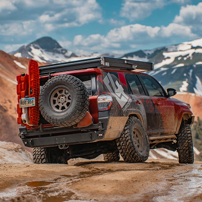
The Mojave Road represents the ultimate Southern California desert adventure through the Mojave Trails National Monument, combining challenging terrain with rich history and genuine remoteness. Whether you tackle the full 138-mile route through the national monument and preserve or explore individual segments, proper preparation ensures this legendary trail delivers the adventure of a lifetime.
Planning your adventure? We've outfitted hundreds of rigs for this legendary route. From heavy-duty skid plates to rock sliders, all-terrain tires, upgraded suspension, and complete recovery kits, we carry the gear that'll get you through those 138 miles of desert challenge. Our team knows what this route demands because we've run it ourselves. Check out our off-road gear and start building your rig today—because out there between Soda Lake and technical sections, you want equipment you can trust.nt equipment you can trust.
Comments will be approved before showing up.