Your Cart is Empty


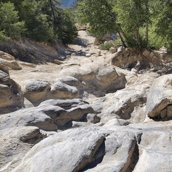
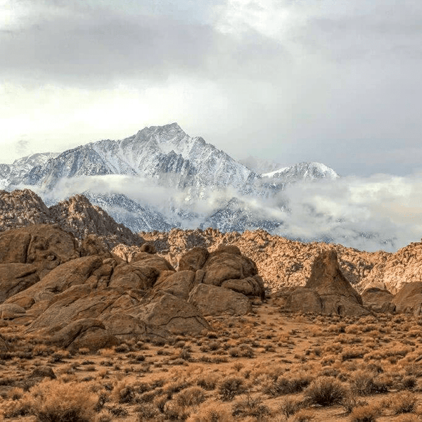
The granite rocks glow orange in the early morning sun, framing Mount Whitney's snow-capped peak in the distance. You're winding through narrow passages between boulders, the Sierra Nevada rising 10,000 feet above the desert floor. This is the Alabama Hills, and it's unlike anywhere else you'll see or drive.
Most people exploring Alabama Hills for the first time are surprised by the accessibility. You get a very nice mix of geology, movie history, and Alabama Hills off road trails ranging from easy scenic drives to moderate technical routes that'll reward your planning with unforgettable views.
Alabama Hills sits in the Owens Valley just south of Bishop and west of Lone Pine, California, where rounded granite formations contrast with the jagged Sierra Nevada peaks. The Bureau of Land Management (“BLM”) manages the Alabama Hills National Scenic Area, which features some of the most photogenic rocks in the entire area. Mount Whitney (the highest peak in the lower 48 at 14,505 feet) dominates the western skyline and is a must see for those in the area. It is hard to miss.
It is said that the Alabama Hills earned their name during the Civil War when Southern sympathizers named them after the CSS Alabama. Today, they're better known for Hollywood history. Over 400 movies have been filmed here, from classic Westerns to modern films. It is expected that movies will continue to feature the beautiful landscapes of the Alabama Hills long into the future. Movie Road and Movie Flat reference this legacy, with routes passing through locations where countless productions were shot.
Alabama Hills trails are not considered the most difficult, but one can argue that they are the most scenic. The Alabama Hills trail network connects via Movie Road, which runs through the heart of the formation. Most routes follow sandy washes, granite corridors, and open desert. Cell service disappears quickly once you leave Highway 395. The nearest services are in Lone Pine, 3-4 miles east. Make sure to stop at the Eastern Sierra Visitor Center for current maps, camping permits, and updated regulations before your trip.
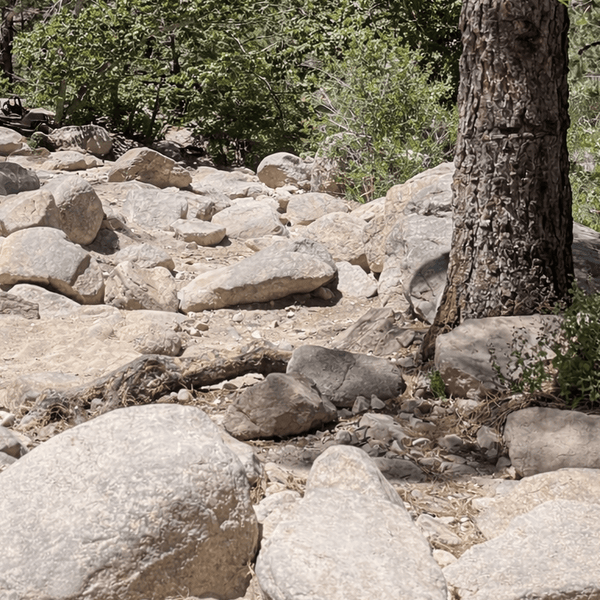
Alabama Hills trails can be grouped into two categories: easy and moderate. All trails can be accessed and enjoyed with a 4WD vehicle with adequate tires.
Easy Trails: Stock high clearance vehicles recommended. Basic 4WD helps but isn't always required. Wide routes with mild obstacles, great for photography and family adventure.
Moderate Trails: 4WD required with all-terrain tires. Technical sections need careful line choice and experienced drivers.
For easy trails like Movie Road and arch access routes, a stock rig handles everything. Street tires can work on the main route, though all-terrain tires provide better grip and more security in sandy and rocky sections. The moderate trails (Hogback Road, northern vista spurs) require 4WD with all-terrain tires and adequate ground clearance.
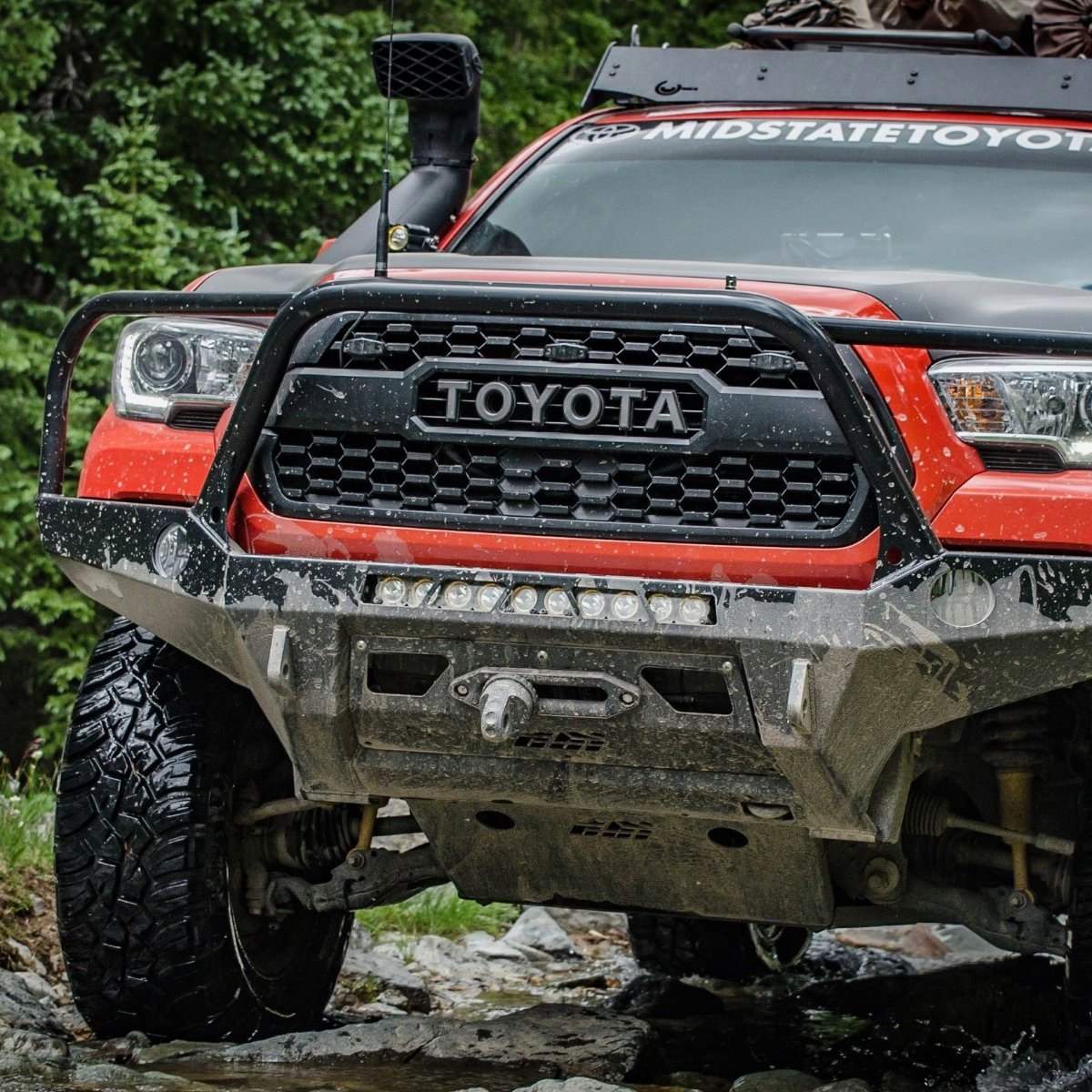
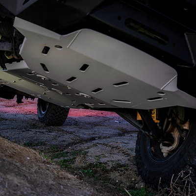
We always recommend packing recovery gear for any off-highway trip: tow straps, D-rings, shovel, MAXTRAX, and a way to air back up. Bring extra water, download maps before arriving, and a full-size spare. The sharp granite rocks are known to puncture tires. Plan to air down to 20-25 PSI for better traction.
Spring (March-May) and fall (September-November) offer the best conditions. Summer heat makes midday driving miserable and winter can bring snow to higher elevations. The main entry point is Whitney Portal Road west from Lone Pine. Movie Road begins about 2.5 miles from the highway. There's no day-use fee, but a free permit may be required for camping. Make sure to check with BLM for any updates. The closest BLM field office is in Bishop just a short drive to the north of Alabama Hills.
|
Segment |
Difficulty |
Miles |
Typical Time |
Highlights |
Best Season |
Suggested Rig |
|
Movie Road Trail |
Easy |
~17 |
1–2 hrs |
Film history, arches, sweeping Sierra views |
Year-round |
Stock SUV / 2WD |
|
Mobius Arch Trailhead Spur |
Easy |
~3 |
<1 hr |
Iconic arch, short hike, photo hotspot |
Year-round |
Stock SUV / AWD |
|
Boot Arch & Shark Fin Spurs |
Easy |
~4 |
1 hr |
Distinctive arches, climbing area, photography |
Fall–Spring |
Stock 4WD |
|
Hogback Road (Whitney Portal Connector) |
Moderate |
~10 |
1.5–2 hrs |
Elevation change, granite corridors |
Spring–Fall |
4WD w/ A/T tires |
|
Moffat Ranch Road (North Connector) |
Moderate |
~8 |
1–2 hrs |
Northern loop, open desert views |
Spring–Fall |
4WD aired down |
|
North Alabama Hills Vista Spurs |
Moderate |
~6 |
1–2 hrs |
Elevated vistas, rock formations, solitude |
Fall–Spring |
4WD / A/T tires |
Mobius Arch: The most photographed formation in Alabama Hills. A quarter-mile walk from the trailhead leads to the arch, which frames Mount Whitney perfectly. The parking area fills up quickly on the weekends, so arrive early for photos and to explore without crowds.
Boot Arch: Located deeper in the hills, this formation resembles an overturned cowboy boot from certain angles. The approach involves tighter passages between rocks, though nothing technical for stock vehicles.
Movie Flat: Wide open areas where countless Westerns were filmed. The scenery hasn't changed since Hollywood's golden age. You'll recognize formations from classic movies as you drive through.
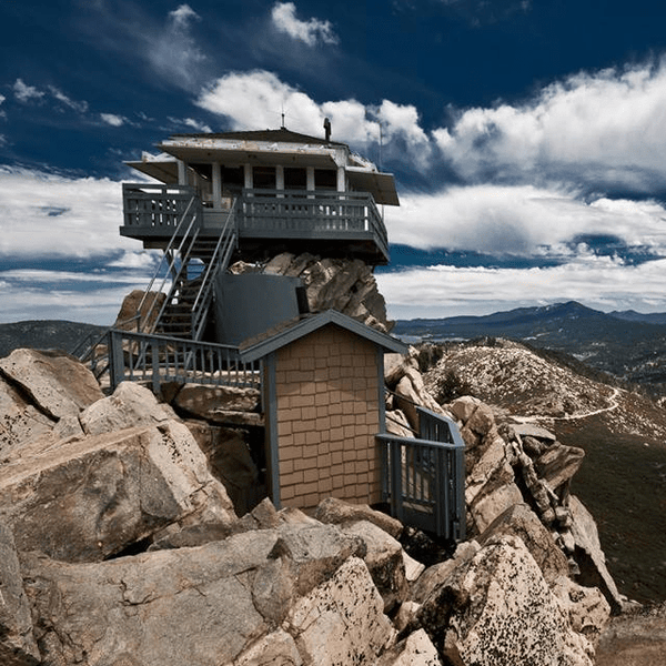
Whitney Portal Road: This paved route provides access to Whitney Portal at 8,300 feet and connects to Hogback Road. The portal area offers alpine views and hiking access to Mount Whitney.
Movie Road is no doubt the most popular and well-traveled route in the Alabama Hills. If run as a loop, the total distance is approximately 17 miles. The road is wide, well-maintained, and suitable for most stock rigs year-round, with two-wheel drive acceptable in dry conditions. You'll pass numerous filming locations from Hollywood's golden age. Unfortunately some of the interpretive signs with information have faded so you may only recognize some filming locations based movies you know well.
The route takes 45 minutes to an hour without stops, though you should add extra time for pulling off at the many prime photo opportunities. Movie Road connects to all other trail spurs in the area, making it the natural starting point for exploring Alabama Hills. Surface conditions vary from packed dirt to more sandy in shaded sections, so speed and caution depend on what you encounter and the vehicle you have.
The full loop showcases the entire range of terrain, from the wide open Movie Flat to tighter passages between boulders. Most drivers complete half the loop and return the same route rather than doing the full circuit. This easy trail is the perfect introduction to the area before tackling more technical routes like Hogback Road.

The Mobius Arch access spur branches off from Movie Road and runs about 3 miles round trip, ending at a dead end parking area. From there, it's an easy walk of about a quarter mile on foot to the arch itself (totally worth it!). The driving portion presents zero challenges for any stock rig, and the entire trip takes under an hour plus whatever time you spend at the arch.
The arch frames Mount Whitney in the background, creating the classic Alabama Hills photo that everyone wants. Early morning and late afternoon provide the best light for photography, with the granite glowing orange with the Sierra peaks dramatically lit. The walking trail is family-friendly and accessible to most hikers regardless of fitness level.
This spur works as a quick stop during a Movie Road loop or as a standalone destination if you're short on time. Budget 30-60 minutes total if you're shooting photos, as the location rewards patience and waiting for different lighting conditions throughout the day. You also might encounter others looking for the most optimal photo opportunity which could delay your photo.

Boot Arch sits deeper in the formation, accessed via spur trails off Movie Road that cover about 4 miles combined and takes roughly an hour to explore. The route sees less traffic and offers more solitude than Mobius Arch mostly due to its location. Several rock formations in this area are popular with climbers, so you'll often see people rock climbing.
The approach involves navigating between granite outcrops on sandier trails. Nothing is too technically challenging, but a stock 4WD can help in loose sections where two-wheel drive might struggle. Park a short distance from the formations and walk the rest of the way to avoid damaging the area.
Respect climbing access by parking away from route bases where climbers start their ascents. You'll often see tents and camp setups during peak season as climbers use this area as a base for multi-day climbing trips.

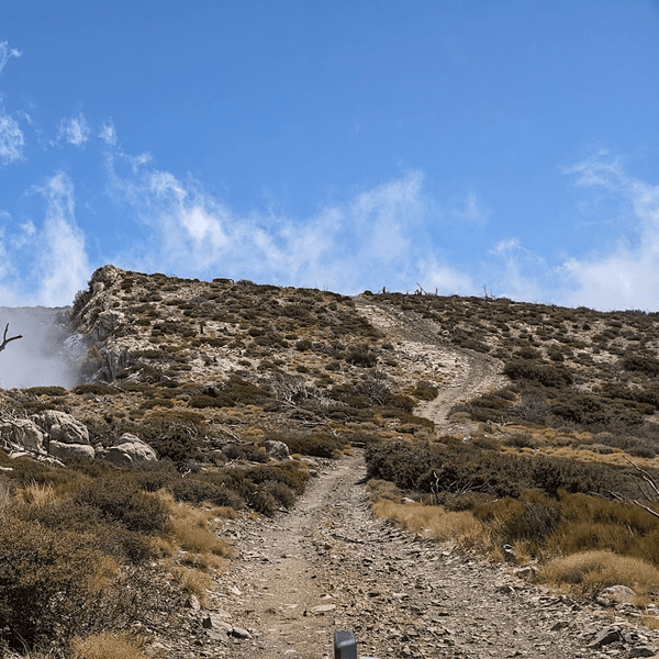
Hogback Road connects Alabama Hills to Whitney Portal Road at higher elevation, covering approximately 10 miles that typically take 1.5-2 hours to complete. This is where the system transitions from scenic drive to technical trail, rated as moderate difficulty and requiring 4WD with all-terrain tires. The route climbs through granite passages and offers elevated perspectives across the entire valley.
The trail branches off from Movie Road near Boot Arch and immediately begins an upward ascend. Surface conditions include embedded rocks, loose gravel, and off-camber sections that demand attention and careful throttle control. The "hogback" name comes from the exposed ridgeline midway through, where the route climbs onto a granite spine with steep drop-offs on both sides.
Technical challenges include several rocky climbs and tight turns requiring careful line choice and sometimes multiple attempts to find the right path. Stock 4WD vehicles with all-terrain tires handle it, but you'll want to pick your lines carefully through the roughest sections. Airing down to 20-25 PSI helps with better traction and more stability.
The northern exit meets Whitney Portal Road about 2 miles above the main Alabama Hills entrance, giving you the option to continue up to Whitney Portal itself or return to Lone Pine via pavement. Most drivers tackle Hogback as a one-way route and return via pavement rather than backtracking. Budget 1.5-2 hours for the drive, more if you stop at viewpoints along the ridgeline.

Moffat Ranch Road forms the northern loop through Alabama Hills, covering approximately 8 miles and taking 1-2 hours to complete. This moderate difficulty route connects Movie Road back to Whitney Portal Road and requires 4WD with aired down tires recommended for the sandy sections. The route sees less traffic than southern trails and offers a different character, with more open desert and fewer boulder formations.
The western access point branches north from Movie Road in the central portion of the trail system. The route immediately enters sandy washes, requiring 4WD and lower tire pressure for added traction. The sand alternates with packed dirt and embedded rock sections, keeping you engaged throughout the drive. Drop to 20-25 PSI for better traction in the deeper sand pockets.
Midway through, the trail passes old ranch structures on private property, so stay on the trail and don't cut across sections that might cross private land. The route continues east through open terrain where views shift from the granite formations to broader desert landscapes, with the Sierra still dominating the western horizon.
Technical challenges come from deep sand pockets and wash crossings that can catch stock rigs off-guard, especially if you haven't aired down. Watch for embedded rocks hidden in the sand, as they can surprise you. The eastern exit meets Whitney Portal Road north of the main Alabama Hills entrance, allowing loop options combining Movie Road, Hogback Road, or Moffat Ranch Road in various configurations.

Several unnamed trails branch into the northern section, covering about 6 miles taking 1-2 hours to explore depending on how many spurs you attempt. These moderate difficulty routes climb to elevated vista points and see minimal traffic, rewarding exploration with unique perspectives on the entire area. You'll need 4WD with all-terrain tires to handle the rougher conditions safely.
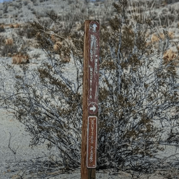
The spurs may not be marked on some maps, but tire tracks make them visible on the ground from previous rigs. As a reminder just because you see tire tracks that does not mean it is a legal trail. Consult official BLM maps and trail markets to verify what is and what isn't a legal trail.
These trails work best for experienced drivers comfortable with route finding and technical terrain. Great views make the effort worthwhile, showing the full scope of Alabama Hills from elevated positions.

Half-Day Scenic (3-4 hours):
Drive Movie Road loop, stop at Mobius Arch for the short hike, continue past Movie Flat. Works for any vehicle and first-time visitors wanting to explore the highlights.
Full-Day Technical (5-6 hours):
Start with Movie Road, branch to Boot Arch, tackle Hogback Road north, exit to Whitney Portal Road, return via the northern route. Combines scenic sections with moderate challenges. Requires 4WD.
Photography Focus (4-5 hours):
Time your arrival for early light at Mobius Arch, explore Movie Flat for film locations, visit Boot Arch mid-morning, return for evening light. Prioritizes best photo locations over maximum mileage.
Most GPS apps show Movie Road and main arch trailheads. Download maps before losing cell service. The Eastern Sierra Visitor Center in Lone Pine and the BLM office in Bishop provides area information and paper maps.
Navigation is straightforward once oriented. Movie Road forms the spine, with other routes branching from it or connecting to Whitney Portal Road. The Sierra Nevada provides a constant western reference point.
Key waypoints: Movie Road entrance (36.6015°N, 118.1235°W), Mobius Arch trailhead (36.6113°N, 118.1248°W). These anchor your route planning and help with finding specific formations.
Camping regulations in the Alabama Hills National Scenic Area have changed significantly. A free camping permit is now required for all overnight stays and can be obtained through the BLM website or at the Eastern Sierra Visitor Center in Lone Pine.
Pack out everything you pack in, including all trash. Critical: You must pack out all solid human waste and toilet paper using a portable toilet system or WAG bag. Burying human waste is not permitted in this area. Bring waste disposal supplies with you, as they're not available on-site. Note that the BLM has placed six porta potties in the Alabama Hills so that may be a more convenient option.
Fire restrictions vary seasonally. Check current regulations with the BLM before planning campfires.
Respect private property near old structures. Stay on established trails and public lands. Rock climbers have access to many formations, so park away from climbing areas and don't block approaches to routes.
Stay on established trails to prevent damage to biological soil crusts between rocks. These fragile desert soils take decades to recover from vehicle tracks. The increased visitation has led to stricter regulations designed to preserve this unique landscape.
Light makes or breaks your trip. Early morning and late afternoon transform the rocks from dull brown to glowing orange. Plan driving around photo opportunities, not just covering miles.
Water is critical. There are minimal sources in the hills. Bring a gallon per person minimum for day trips. Double that for summer conditions or camping overnight.
Bring WAG bags or a portable toilet system if you're planning to camp or spend extended time in the area. You're required to pack out all solid human waste. These supplies are available at outdoor retailers in Lone Pine or the Eastern Sierra Visitor Center.
Afternoon winds pick up regularly, especially in spring. They'll sandblast your rig and make driving less pleasant. Tackle technical routes in the morning when conditions are calmer.
Scout obstacles on foot when uncertain. The granite hides edges that aren't visible from the driver's seat. A 30-second walk prevents damage and stuck situations.
The formations look similar from inside the trail system. Mark your camp or parking location on GPS so you can find it again. "Near the big rock" doesn't narrow things down much here.
Check tire pressure before starting technical trails. Running aired down on pavement back to town damages tires. Bring a portable compressor or plan to air up at the gas station in Lone Pine.
Alabama Hills delivers stunning scenery, manageable trails, and easy access from Highway 395. The combination of dramatic geology, movie history, and varied route difficulty makes it worth multiple visits. Whether you're driving Movie Road in a stock SUV or pushing through Hogback Road's technical sections, the Sierra Nevada backdrop turns every route into something memorable.
The trails reward exploration at any pace. Spend an afternoon hitting the highlights, or invest a weekend in covering every spur and vista point. Either way, you're driving through one of California's most unique landscapes.
If you're looking to upgrade your rig before your next adventure, feel free to browse the accessories and gear we have here at Truck Brigade. Safe travels out there.
Comments will be approved before showing up.