Your Cart is Empty


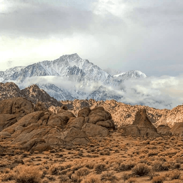
Big Bear, located in the beautiful San Bernardino mountains within the San Bernardino National Forest offers Southern California's premier mountain off-roading experience, combining challenging terrain with stunning alpine scenery around Big Bear Lake. At elevations ranging from 6,000 to over 9,000 feet, trails in the Big Bear area wind through wooded forests, open meadows, and granite boulder fields while offering incredible views of the surrounding mojave desert.
The area's rich gold rush history adds character to every adventure, from remnants of 1860s mining operations in Holcomb Valley to historic fire lookouts perched on commanding peaks. Big Bear's trail network is vast and includes everything from easy forest roads perfect for family trips to gnarly boulder crawls that will test the most capable rigs and experienced drivers.
Looking for Other Southern California Off-Road Trails? Check out our So-Cal Off-Road Trail Guide
Our trail difficulty system reflects both technical challenges and vehicle requirements to help you choose appropriate routes for your rig and skill level:
Easy Trails: Stock high clearance vehicle recommended. Basic 4WD is helpful but not always required. Wide routes with mild obstacles, good for family weekend trips and scenic route exploration.
Moderate Trails: 4WD required with all-terrain tires. Technical sections require careful line choice. While stock vehicles can complete most of all of the trail with experienced drivers, it is recommended to have an upgraded rig .
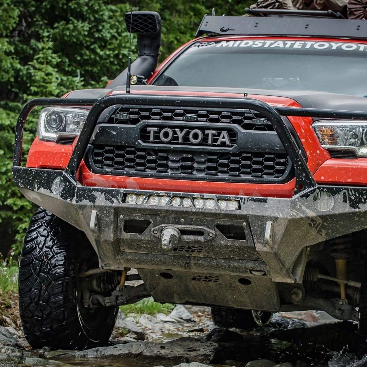
Hard Trails: Built rigs are essential. Large tires, lockers, armor, and recovery gear required. Sustained technical challenges with potential for vehicle damage. Advanced driving experience necessary.
Beyond meeting minimum requirements, smart preparation enhances both safety and enjoyment. Air down your tires 5-10 PSI from highway pressure for better traction and ride comfort on easy trails. On more advanced trails you will want to air down even more to 10-20 PSI. Carry a portable compressor for airing back up before hitting pavement.
“If you don’t have a compressor or forget to bring one, limp to a Big Bear gas station to refill your tires.”
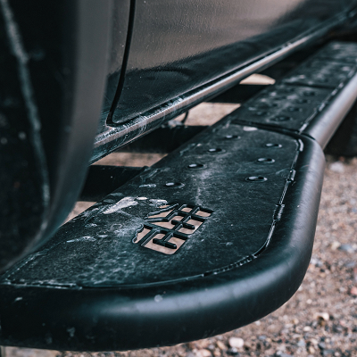
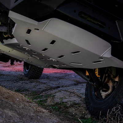
For moderate trails, rock sliders protect vulnerable rocker panels, and skid plates can shield oil pans and transfer cases from impacts. Upgraded shocks improve control on washboard sections and provide better articulation over obstacles.
Advanced builds heading for more advanced trails can benefit from aftermarket bumpers with integrated recovery points and winches, differential breathers extended above potential water levels, and upgraded axle shafts to handle the stress of locked differentials. It can be helpful to carry a hi-lift jack and MAXTRAX for self-recovery situations.
Regardless of difficulty, pack essentials: recovery straps, first aid kit, basic tools, extra water, emergency food, and satellite communicator or Personal Locator Beacon (PLB) for true emergencies. Download offline maps using apps such as onX Offroad or Gaiasince cell coverage is unreliable throughout the forest.
“A Forest Service Motor Vehicles Use Map (MVUM) is another great option that can be downloaded via Avenzaand provides routes, trails, and other areas designated as open to motorized travel.”
Late spring through early fall offers optimal conditions for most Big Bear trails. Winter can bring trail closures especially for some of the more advanced and hard to access trails at the highest elevations. Rest assured that trails such as Holcomb Valley stay open year-round, but may be impassable or more difficult in winter months due to the snow pack.
Some of the areas in the San Bernardino Mountains can feel desolate. Always inform others of your plans and expected return. If you find yourself in trouble on a trail and don't have the necessary recovery gear, consider contacting Big Bear Off-Road Recovery, a local company who is open 24 hours and can help with recoveries..
|
Trail |
Difficulty |
Miles |
Typical Time |
Highlights |
Best Season |
Suggested Rig |
|
Holcomb Valley Trail |
Easy |
~26 |
2–3 hrs |
Historic sites, meadows, broad views |
Spring–Fall |
Stock SUV/4WD |
|
Butler Peak Road |
Easy |
~10 |
1.5–2 hrs |
Summit views, mellow grades |
Late Spring–Fall |
Stock SUV/4WD |
|
Gold Mountain |
Moderate |
~12 (OAB) |
2–4 hrs |
Rocky climbs, summit vistas |
Late Spring–Fall |
4WD low, A/T tires; sliders helpful |
|
White Mountain |
Moderate |
~7.5 |
1.5–3 hrs |
Overlooks, switchbacks |
Spring–Fall |
4WD, A/T tires |
|
Burns Canyon |
Moderate |
~18–20 |
3–4 hrs |
Forested canyon, seasonal crossings |
Late Spring–Fall |
Stock 4WD w/ A/T tires |
|
John Bull |
Hard |
~5.5 |
2–4+ hrs |
Boulder fields, sustained tech |
Late Spring–Fall (dry) |
33–35"+, lockers, armor, winch |
|
Holcomb Creek |
Hard |
~8.5 |
3–6 hrs |
Rock garden start, creek crossings |
Late Spring–Fall (low water) |
33–35"+, lockers, armor |
|
Dishpan Springs / Crab Flats |
Hard |
~4 |
2–4 hrs |
Steep climbs, off-camber |
Late Spring–Fall |
Lift, 33s+, traction aid |
Holcomb Valley Trail (Forest Road 3N16) is Big Bear’s classic first taste of alpine wheeling—a 26-mile scenic route from Green Valley Lake Road to the dump access road near Baldwin Lake, winding through pine forests, open meadows, and the gold-rush history of Holcomb Valley.
Most of the route is smooth and stock-SUV friendly, with wide pullouts for photos and picnics; plan on 2–3 hours at an easy pace. You'll roll past historic cabins and diggings with long views across the valley that are especially gorgeous near golden hour.
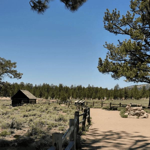
This scenic route through Holcomb Valley offers a wonderful introduction to Big Bear off-road exploration. The trail winds through pine forest and open meadows with multiple stops along the famous Gold Fever Trail. Historic mining sites and the iconic Holcomb Valley Ranch area provide excellent opportunities for wonderful pics and a fascinating history lesson about Southern California's gold rush era.
Trail conditions are generally mild, but expect washboards, shallow ruts, and a few short sections that may call for 4-High after storms or spring snowmelt. Keep speeds conservative around blind corners. This corridor is popular with hikers, cyclists, and other OHV users. Multiple signed junctions make it simple to shorten the loop or peel back toward Big Bear Lake if the weather turns.

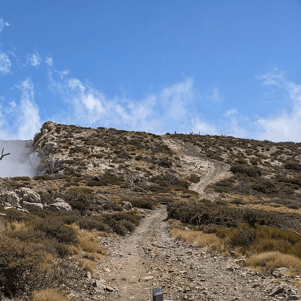
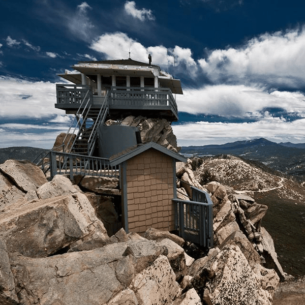
Butler Peak Trail (Forest Road 2N13B) delivers Big Bear's most accessible summit experience, a 10-mile round trip to panoramic views from 8,535 feet. The well-maintained fire road climbs through mixed pine forest, beginning near Fawnskin (east side of Big Bear Lake) (with gradual switchbacks that stock vehicles can handle easily. Note that Forest Roads 2N13 and 2N13B, which give access to Butler Peak, close in the winter and therefore the lookout cannot be accessed in winter months.
At the summit you can often find friendly volunteers who share information about the fire lookout and surrounding peaks. Views stretch across the San Bernardino National Forest from the San Gabriel Mountains to the Mojave Desert. Big Bear Lake can be seen below, providing terrific photo opportunities. Plan 1.5-2 hours for this family-friendly adventure that offers incredible summit views without technical driving challenges.

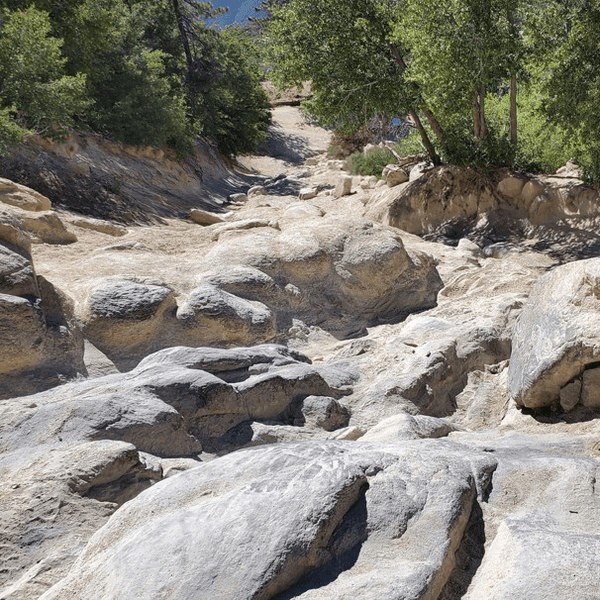
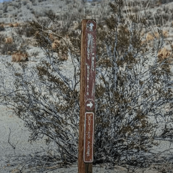
Gold Mountain Trail (Forest Road 3N69) serves up Big Bear's most approachable technical driving experience via Highway 18 (North Shore Drive) near Baldwin Lake. . The 12-mile out-and-back route combines forest roads with legitimate rock crawling through challenging terrain that builds progressively as you climb.
The adventure features the famous "Ledge," "Brain," and "Rock Garden" sections that provide excellent obstacles for drivers looking to advance their off-roading skills. Built into a former scenic drive from the 1930s, portions of deteriorated pavement actually add character to the challenge. Stock 4WD vehicles can complete this trail with careful driving, but we highly recommend tackling the trail with a built out rig so you can take advantage of some of the most technical features..

White Mountain Trail (Forest Road 3N17) which starts as an offshoot of Forest Road 3N16 up to White Mountain Peak and down to Forest Road 4N16 offers 7.5 miles of varied mountain terrain to elevated viewpoints overlooking Johnson Valley. The trail's difficulty depends on direction, west-to-east provides moderate challenge while east-to-west presents steeper technical sections.
The route climbs through fire-recovery areas where new forest growth creates interesting scenery contrasts. Multiple overlooks provide opportunities to stop and appreciate the dramatic elevation change from mountain forest to high desert. Wildlife viewing opportunities include deer and various bird species, making this a great choice for nature enthusiasts.
Burns Canyon Trail (Forest Road 2N02) presents an 18-20 mile journey from high desert near Pioneertown to Baldwin Lake. This diverse connector showcases Southern California's dramatic elevation changes while providing moderate technical challenges and abundant camping opportunities.
The route begins in classic Mojave Desert terrain with Joshua trees, gradually transitioning through different elevation zones before reaching Baldwin Lake and the great Big Bear area . Multiple creek crossings and varied surface conditions keep the driving experience interesting without overwhelming stock 4WD vehicles.

John Bull Trail (Forest Road 3N10) accessible via Forest Roads 3N16 and 3N02, stands as Big Bear's, and in some cases Southern California’s most notorious challenges, a 5.5-mile boulder gauntlet that has built its reputation as the benchmark for modified 4WD vehicles and expert drivers. This trail doesn't ease you into difficulty; it presents sustained technical obstacles demanding constant attention.
The infamous "Gatekeeper" obstacle sets the tone immediately with vehicle-sized boulders requiring precise line selection. From there, challenges intensify with off-camber traverses, loose rock gardens, and climbs over granite terrain that dwarfs most vehicles. Unlike other Big Bear trails that alternate between technical and easy sections, John Bull maintains relentless difficulty throughout.
Vehicle requirements are non-negotiable: 35"+ tires, front and rear lockers, substantial armor, winch, and complete recovery kit. This trail regularly humbles even experienced wheelers, so honestly assess your skills before attempting. Plan 2-4+ hours for completion, with full days common for larger groups.

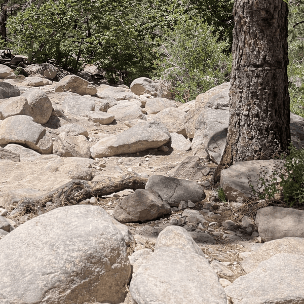
Holcomb Creek Trail (Forest Road 3N93) is accessed off the 3N16 outside of Green Valley Lake and travels 8.5 miles along the Holcomb Creek until it meets Coxey Road. It is considered one of Big Bear's most technical water-and-rock combination trails. This black diamond adventure begins with punishing boulder gardens and transitions to scenic creek crossings through recovering burn areas within the San Bernardino National Forest.
The trail begins with the "Rock Garden Gatekeeper," massive boulders that filter vehicles and skills. Success requires not just ground clearance but precise wheel placement and creative line selection. Beyond initial challenges, the route follows through areas where wildfire damage has created an interesting landscape of forest recovery.
Creek crossings vary seasonally from gentle fords to challenging water features. During drought years, crossings can barely wet tires; in wet seasons, water depth challenges even prepared vehicles. The remote character demands self-rescue capability since recovery operations are complicated by technical terrain.

Dishpan Springs Trail (eastern part of Forest Road 3N34) is accessible from Forest Roads 2W03 or Hook Creek Road. This trail represents 4 miles of steep, technical terrain connecting Lake Arrowhead trails to Big Bear's trail network. Despite its short length, this trail packs serious challenges including the notorious "Waterfall" obstacle, a steep, deeply rutted rock face where body damage is common.
Multiple off-camber sections require precise throttle control and sometimes backing up to try different approach angles. The terrain punishes mistakes severely, but provides an excellent challenge for experienced drivers with properly equipped rigs.

Family Weekend: Holcomb Valley Road with Gold Fever Trail stops, combining scenic views with fascinating gold rush history. Plan 2-3 hours with plenty of photo opportunities and picnic spots.
Moderate Challenge: Gold Mountain Badge of Honor trail morning session, followed by White Mountain overlooks in the afternoon for varied terrain and skill building.
Advanced Test: John Bull Trail as a full-day commitment. This demanding route requires complete focus and should be attempted only with proper equipment and experienced drivers.
Weekend Explorer: Day 1 - Holcomb Valley Road with Gold Fever Trail stops. Day 2 - Butler Peak for sunrise views.
Technical Skills Weekend: Gold Mountain Badge of Honor trail morning, White Mountain overlooks afternoon, Burns Canyon camping for extended adventure.
Advanced Challenge Weekend: John Bull Trail (full day), followed by Holcomb Creek if time and energy permit. Plan extra recovery time and ensure all group members have advanced experience.
Base Camp: Big Bear Lake area offers everything from primitive camping to luxury cabins. Big Bear also has many AirBnB options. The Big Bear Discovery Center provides maps, current conditions, and Adventure Pass sales.
Navigation: Download offline maps before heading out. Cell service is spotty throughout the mountain, making GPS backup crucial for safety. Current Motor Vehicle Use Maps show designated routes.
Permits: An Adventure Pass required for most parking areas. Group permits needed for 7+ vehicles.
Stay on designated routes shown on the current Motor Vehicle Use Maps (MVUM). The San Bernardino National Forest's fragile mountain ecosystems recover slowly from damage. Pack out all trash and respect wildlife. Proper food storage is also mandatory in bear country.
Yield uphill traffic right-of-way and communicate courteously with hikers, mountain bikers, and other trail users. Keep engine noise reasonable, especially near camping areas and during evening hours. When spotting others through obstacles, ensure clear communication and follow established safety rules.
Maintain access through responsible use. These incredible Big Bear trails represent collaboration between users, volunteers, and the Forest Service. Following Leave No Trace principles ensures future generations can enjoy these Southern California off-road trails.
Comments will be approved before showing up.