Your Cart is Empty


Those that live in Southern California or frequent the area know how much time is spent on freeways such as the 91. There is no doubt that there are some of the best and scenic trails in Southern California, but getting to those trails in a reasonable amount of time can be challenging. Now, we cannot solve the traffic problems in So-Cal, but we can offer up some great information on trails that will help you get away from the traffic jams.
Butler Peak Trail located near the city of Big Bear Lake could be that answer.
Located on the north side of Big Bear Lake, this trail serves up what is arguably one of the best panoramic views of Big Bear Lake and the entire region. It’s accessible enough for a stock 4x4 daily driver, but interesting enough for a fully built overland build to stretch its legs. It sits in a sweet spot of adventure, easy enough to be relaxing, but technical enough near the summit to keep your hands tight on the wheel.
Looking for other Big Bear trails? Check out our Big Bear Off-Road Trail Guide
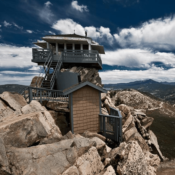
Butler Peak is a destination with deep roots in the history of the San Bernardino National Forest. The Butler Peak Fire Lookout was originally built in 1936 by the Civilian Conservation Corps (CCC). It was named after George Butler, an early ranger who was instrumental in mapping the area for fire protection.
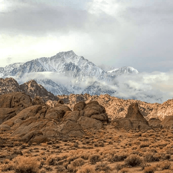
Sitting at an elevation of about 8,535 feet, it holds the title of the highest fire lookout in the San Bernardino Mountains. For truck owners and overlanders, this matters because the terrain changes drastically as you climb. You start your journey in the dense jeffrey pine trees and manzanita of the lower valley, but by the time you reach the parking area for the hiking area at the top, you are on an exposed, granite peak with thin air and endless visibility.
From the catwalk of the lookout tower, you are met with 360-degree stunning views that are hard to beat. To the south, the massive face of Mt. San Gorgonio (the highest peak in Southern California) dominates the skyline. Look north, and the landscape drops away dramatically to the high desert floor of Apple Valley and Lucerne Valley. On a clear day, you might even be able to see the Sierras in the distance.

You don't need long-travel suspension or a fully built rig for this one, but you do need to be prepared (like you should be for any trail honestly). A stock 4x4 or AWD crossover with decent ground clearance (think Subaru Outback or better) and good tires can generally handle the route.
However, do not underestimate the trail and the changes that can occur during different seasons. The lower section of 2N13 is notorious for heavy corrugations. If you are running a stock suspension, you might be in for a jarring ride. This is where upgraded shocks and suspension more broadly really shine. The damping ability of a performance shock allows you to float over the chop rather than rattling every coin out of your cupholder.
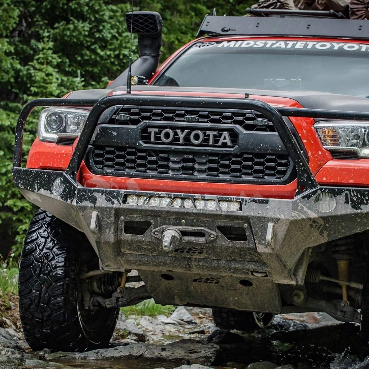
Tires: We recommend All-Terrain (A/T) tires at a minimum. While you won't be crawling over boulders, the road is littered with sharp granite rocks. P-rated street tires are susceptible to sidewall punctures here. A Light Truck (LT) tire with a stronger sidewall is the smart move. Not to mention you might come in contact with snow in the Big Bear area especially in winter months which is another great reason to be prepared with All-Terrain tires. We have had great luck with BFG tires over the years.
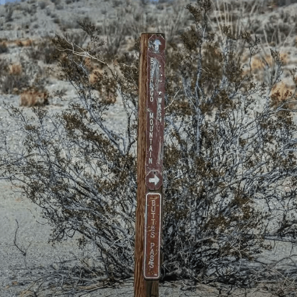
Most people get turned around trying to find the entrance because there isn't a massive neon sign illuminating the way. You have three main ways to reach the north shore of Big Bear, where pavement turns to dirt.
The "back way" is our preferred route if you are coming from the High Desert or the Victorville/Apple Valley area. It avoids the heavy city traffic and the winding mountain roads of the front side and can be a helpful route for those looking to access the Big Bear area on holidays and weekends where the other routes might be jammed for hours. Honestly, even if this route is not the most direct it might be the quickest depending on traffic.
The standard route for those located in the Inland Empire. This can be the quickest on low traffic days for those coming from Orange County and Riverside County, but on some weekends especially holiday weekends this route can take a long time due to traffic, rock slides, etc.
A longer, winding route, but more picturesque that can often have less traffic.
The primary entrance is near the Fawnskin Fire Station (a great landmark).
Once you air down and leave the pavement, the adventure begins. Here is what you can expect on the drive up.
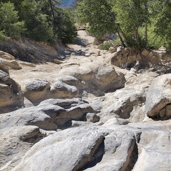
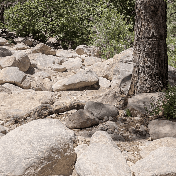
The Butler Peak Trail (Forest Road 2N13) starts wide and graded. You’ll cruise through dense Jeffrey pines and heavy brush. In the spring, the low-lying shrubs are bright green, but by late summer, it can be a dusty affair.
The Challenge: Washboards. This section sees a lot of traffic from campers and hikers. As a result, the road surface is often rippled like a washboard.
As you gain elevation, the trees begin to thin out. You will start to catch glimpses of Big Bear Lake to your right. The road remains wide enough for two vehicles to pass comfortably, but keep your eyes peeled. This is a popular route, and you will encounter mountain bikers and other trucks coming down.
You will eventually reach a major intersection known as the Holcomb Valley Junction.
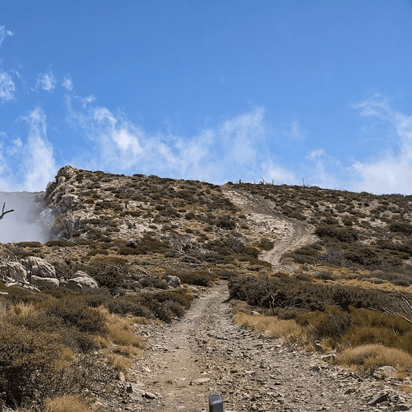
About a mile from the top, the character of the trail changes. You turn onto 2N13B, the spur road that leads directly to the lookout.
Warning: This is where it gets tight. The road narrows significantly. It becomes a shelf road cut into the side of the granite peak. There are no guardrails. You will encounter several tight switchbacks that require your full attention.
Finally, you will arrive at the parking area just below the tower. It’s a small dirt lot that can fit about 10-15 vehicles. On a busy weekend, it fills up fast.
Once you park, the driving is done, but the climb isn't. You have a short but steep walk to reach the actual lookout.
The trail winds its way up the final granite knob of the peak. It’s about a quarter-mile hike, but at 8,500 feet, you will feel the altitude. Take your time. As you ascend, the views get better with every step.
When you reach the lookout tower, you are standing on top of the world. If the volunteers are staffing the tower (usually on weekends from Memorial Day to Labor Day), they will often invite visitors up to the catwalk.
Note: The tower itself is an active fire detection facility. If there is a fire in the area or if operations are busy, access may be restricted. Always be respectful of the staff, they are there to keep the forest safe.

We like this area because it’s modular. You can do a quick run or build out a full-day expedition. Here are three ways to play it.
The drive is beautiful, but you’ll want to get out and stretch your legs. Here are the top stops you shouldn't miss.
|
Stop |
Description |
Notes |
|
Butler Peak Lookout |
Fire lookout tower at 8,535 ft with panoramic views of Big Bear Lake, Mt. San Gorgonio, and the Mojave Desert. |
Often staffed in summer; short walk from the parking area. |
|
Fawnskin Overlook |
Pull-out views of the north shore of Big Bear Lake. |
Early photo stop before the climb. |
|
Holcomb Valley Junction |
Connection point to 3N16. |
Extends trip into historic mining country. |
|
Forest Pullouts |
Shaded picnic and photo spots along 2N13. |
Ideal for lunch breaks or video/photography opportunities. |
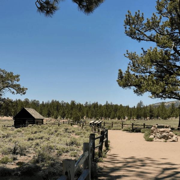
Why rush home? The San Bernardino National Forest offers plenty of opportunities to turn this drive into an overnighter.
For the overland crowd, "Yellow Post" sites are a great option when traveling alone. These are dispersed camping spots that offer seclusion without the amenities (or fees) of a crowded campground. There are several located off 2N13 and 3N16.
If you want to leave the truck behind for a bit, the area is full of trails. While the road to the peak is a drive, you can park lower down and hike up for a workout. The hike up the road offers significant elevation gain and allows you to enjoy the smell of the pine trees without the engine noise.
For a different vibe, check out the trails near Green Valley Lake or Lake Arrowhead to the west. The Pacific Crest Trail (PCT) also crosses 2N13. Keep an eye out for hikers crossing the road.
We lived in Big Bear and spent a lot of time in these mountains, testing gear and exploring routes. Here is the inside scoop to avoid common rookie mistakes.
1. Check the Gate Status: We can't say this enough: Check before you go. The Forest Service closes the gate at the bottom of 2N13 during the winter and early spring due to snow and ice. The road is shaded and can hold snow long after snow has stopped falling. It usually opens Memorial Day weekend, but a heavy winter can push that back to June or July. Always contact the U.S. Forest Service who is located at the Big Bear Discovery Center or check the San Bernardino National Forest website.
2. Air Down: Even though this is considered a fire road, dropping your tire pressure to 20-25 PSI makes a massive difference for both your rig and the trail.
3. Beat the Rush: The Butler Peak Fire Lookout is a popular destination. On Saturdays, it is not uncommon to encounter a handful of people and families. Hit the trailhead by 8:00 AM to avoid the traffic. Alternatively, go on a mid-week run or wait until late afternoon for a sunset run (just be sure to descend before it gets too dark).
4. Pack for Weather: It might be 80° in Big Bear Lake or 100° in the Inland Empire, but at 8,500 feet, the wind can make a difference. The temperature at the peak can be 15-20 degrees cooler than the valley floor. Bring a jacket or a windbreaker.
5. Watch Your Temps: The climb is consistent and long. If your cooling system isn't up to par, keep an eye on your gauges, especially if you are running heavy with gear or towing an off-road trailer. The thin air makes your cooling system work harder.
6. Comms Check: Cell service is spotty at best. Once you pass Fawnskin, you will likely lose signal until you hit the summit. We recommend using GMRS radios to communicate with your group. It’s also safer to call out your position on blind corners.
As off-roaders, it is our responsibility to protect the trail for future generations. The Butler Peak area is pristine, and we need to keep it that way.
The Butler Peak Trail is the perfect excuse to get out of the house and put your truck to use. It offers some of the most stunning views in the state without needing a dedicated rock crawler to get there. It’s a great place to test your vehicle’s capabilities, escape the heat of the city, and soak in the fresh mountain air.
Whether you are hitting the dirt for a quick morning run or linking it up with Green Valley Lake and Holcomb Valley for a weekend expedition, this route delivers big rewards for minimal risk. So, load up the truck, grab your camera, and we’ll see you on the mountain.
Gear Up for the Adventure
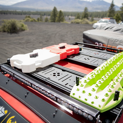
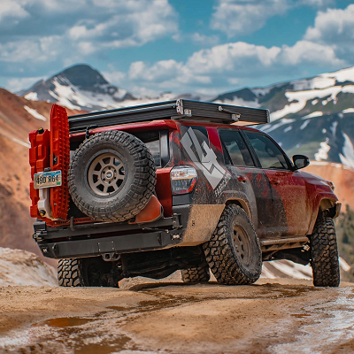
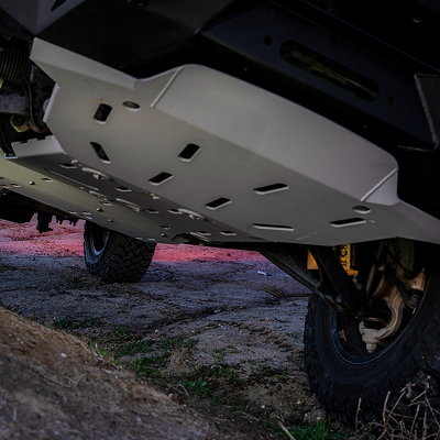
Before you head out, make sure your rig is up to the task. Whether you need to dial in your suspension to handle the washboards, add a roof rack for your extra gear, or grab some essential recovery boards just in case, we have everything you need to build your dream vehicle.
Head over to TruckBrigade.com for industry-leading parts, expert advice, and free shipping on thousands of items. We don't just sell parts; we test them on trails just like this one.
Join the Brigade: Have you conquered Butler Peak? Tag us in your photos or let us know your current trail conditions in the comments below!
Comments will be approved before showing up.