Your Cart is Empty


Dishpan Springs doesn't mess around. At just 2 to 4 miles, it's one of the shortest trails in Big Bear's network, but it packs more consequence per mile than almost anything else in Southern California. The famous waterfall obstacles have ended more days than I can count.
This isn't a trail you casually add to your Big Bear weekend. Dishpan Springs (Forest Road 3N34, also called Deep Creek Trail, Willow Creek Jeep Trail, and Crab Flats OHV Route) is a Black Diamond technical challenge that demands proper gear, a well-built vehicle, and an honest assessment of your skills. The waterfall obstacles on this trail will test even highly capable rigs. The Deep Creek Trail section is particularly notorious.
Let's talk about what you actually need to run Dishpan Springs Trail successfully.
Looking for other Big Bear trails? Check out our Big Bear Off-Road Trail Guide
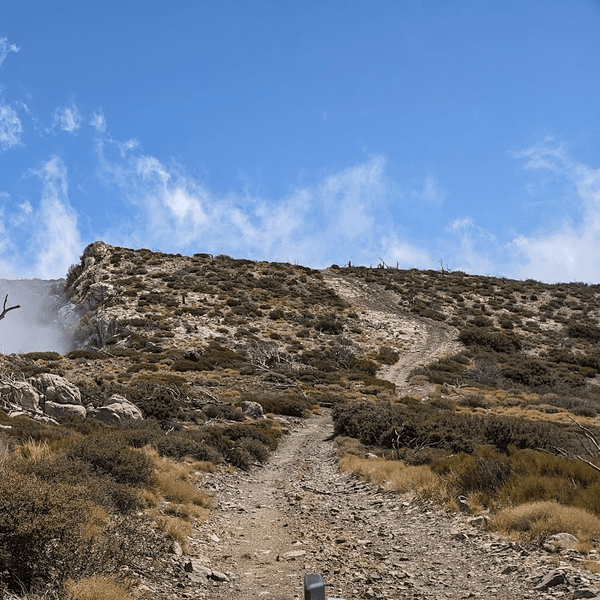
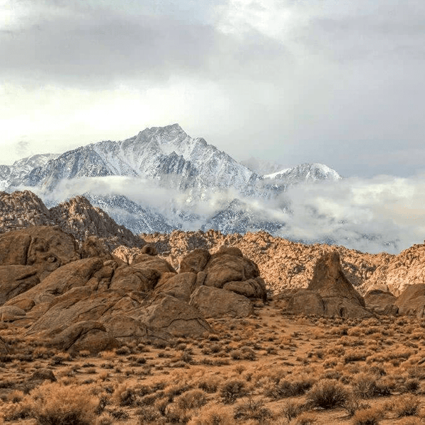
Dishpan Springs Trail is located in the San Bernardino National Forest between Lake Arrowhead and Big Bear, CA. The technical Dishpan Springs section is approximately 2 miles long, running from the Deep Creek Bridge to the Fisherman's Camp trailhead. This 2-mile technical stretch is the heart of Dishpan, though the full 3N34 route with approaches extends to about 5 miles. Dishpan Springs is part of the Crab Flats OHV Road 3N34, also known as Willow Creek Jeep Trail and Deep Creek Trail.
The Dishpan Springs Trail is the only off-road 4x4 trail connecting the off-road trail networks of Lake Arrowhead to the west and Big Bear's Holcomb Valley to the east. The U.S. Forest Service rates this trail as a black diamond, indicating it is highly challenging and extremely difficult.
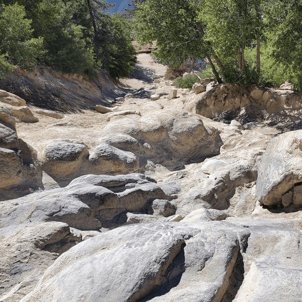
The trail features two notable waterfall obstacles and numerous rocky sections with large boulders, deep ruts, and steep climbs. The Waterfall is a severe, steep, and deeply rutted rock obstacle requiring precise spotting. The steep waterfall obstacles may look intimidating, and while both waterfall obstacles have easier bypass lines to the side (often called the "Tree Line" when going uphill), these bypasses are still rated as difficult.
True stock-friendly bypasses do not exist for the main Waterfall section. Finding the right line on the main waterfall is what makes Dishpan Springs special. The trail is rated as extremely difficult and is not recommended for stock SUVs. It is primarily for modified 4x4 vehicles rather than a typical hiking trail.
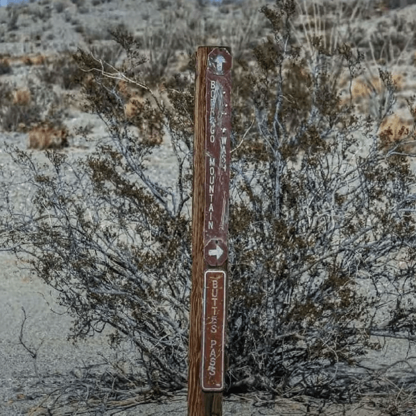
The eastern access via Highway 18 is the most common approach from the Big Bear side. From Highway 18, take Green Valley Lake Road heading toward Green Valley Lake. After approximately 5 miles, turn left onto Crab Flats Road. Follow Crab Flats Road down about 5 miles to the trailhead, where it's accessed at the junction with Forest Road 3N16 near Crab Flats.
This approach puts you at the easier eastern end of 3N34. You'll pass through the easy section before hitting the gate that marks the beginning of the technical western portion. This is the favored direction if you're running Dishpan as part of a loop connecting to Holcomb Creek or other Big Bear trails.
From Highway 330 through Running Springs, continue to Highway 18 and follow the directions above via Green Valley Lake Road. Highway 330 connects to Highway 18 at Running Springs and provides the primary access from the Los Angeles, Orange County, and western areas. Note that Highway 330 can get congested on peak weekends.
Alternatively, from Running Springs, you can connect to Highway 173 heading toward Lake Arrowhead for the western approach.
From Highway 38, access Big Bear and connect to Highway 18, then follow the Green Valley Lake Road directions above.
(Note: as of February 2026, Caltrans is conducting emergency storm repair. Current schedule shows full closure Mondays-Thursdays 7 AM - 5 PM, one-way flagging on Fridays, open on weekends.)
Highway 38 provides access from Redlands and the eastern approach but is typically less congested than Highway 330/18.
For western access from this direction, you can also route through to Lake Arrowhead via Highway 173, though this adds significant mileage.
From Highway 18 near mile marker 24.5, take Highway 173 north toward Lake Arrowhead. From Lake Arrowhead, the trail is accessed via Hook Creek Road (Forest Road 2N26Y). This is the western entrance to Dishpan Springs and the preferred starting point if you're running the trail west to east (uphill on the waterfall, which many consider more challenging but gives better vehicle control).
Dishpan Springs is unique because it's entirely optional suffering. Unlike trails you run to get somewhere, you run Dishpan Springs specifically for the waterfall obstacle. That's it. That's the whole draw. This short but challenging trail in Southern California packs extreme difficulty into just a couple of miles between Lake Arrowhead and Big Bear.
The technical section is short enough that you could winch the entire thing in an afternoon if needed, but the challenge is doing it on your own power. The rocks are often covered with fine sand, making traction unpredictable on Dishpan Springs. The ruts are deep enough to high-center long wheelbase rigs. The angles are also steep enough that rollovers happen.
What makes Dishpan Springs special is the purity of the challenge. There's no scenery to distract you, no gold rush history, no camping destinations. Just you, your rig, and a rock face that doesn't care about your build or your ego.
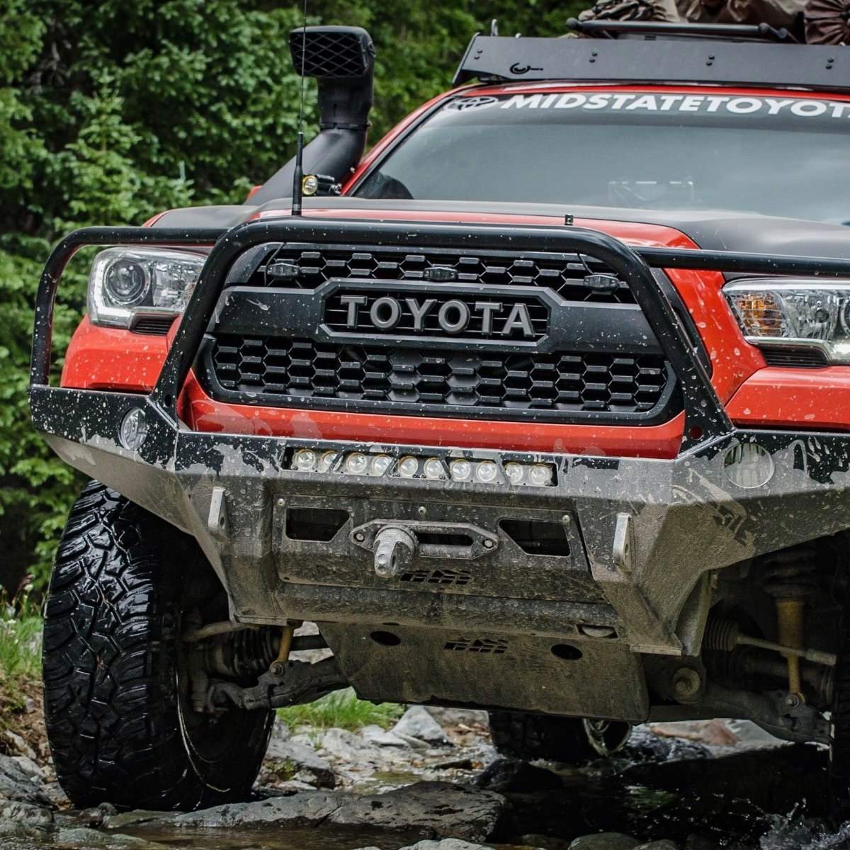
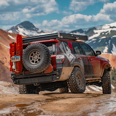
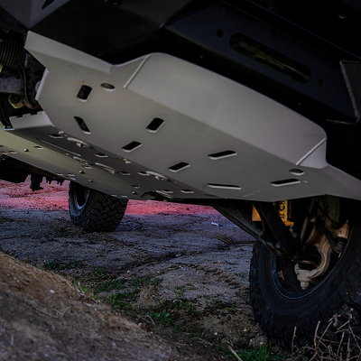
Dishpan Springs Trail is primarily for modified 4x4 vehicles rather than a typical hiking trail. Stock SUVs are not recommended due to the trail's difficulty. Vehicle requirements strongly recommend high-clearance 4x4 vehicles with lockers, 35-inch tires, and skid plates. Modified or lifted 4WD vehicles are essential.
The absolute minimum:
Long wheelbase rigs will struggle more with tight line selection.
The rigs that handle Dishpan Springs comfortably:
This level of build means you're focused on driving, not worrying about breaking something expensive.
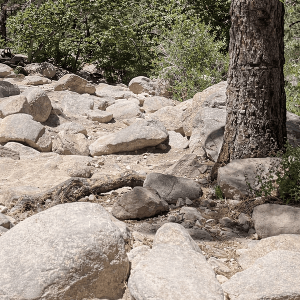
Before you hit the waterfall, there are rock gardens with large boulders and tight lines. Notable features of the Dishpan Springs Trail include steep rocky climbs, deep ruts, and numerous rocky sections. Air down to 12-15 PSI. Use a spotter when you run the trail.

The rocks are granite covered with fine sand. Momentum won't save you here. Precise throttle control and line choice matter more than horsepower.
Between technical sections, the trail narrows through trees. Full-size rigs will get pinstriped. Watch for oncoming traffic and communicate to prevent gridlock.
Deep Creek has a hardened crossing now (technically a concrete box culvert system installed to protect the habitat of the Southern Mountain Yellow-legged Frog and German Brown Trout), making crossings of Deep Creek more manageable.
However, areas around Deep Creek on the Dishpan Springs Trail require bouldering and may involve getting wet when navigating the creek bed. Inclement weather can make crossing Deep Creek impassable despite the culvert, particularly during winter and spring runoff. The culvert crossing itself is paved, but the approaches remain extreme and subject to flooding. Deep Creek used to be one of the most intimidating parts of the Willow Creek Jeep Trail before the Forest Service added this hardened crossing.
Best Season: Late spring through early fall (May-October). Snow and ice during the winter months can add extreme difficulty to navigating the Dishpan Springs Trail.
Time Required: The trail typically takes 1-2 hours to complete for well-equipped groups. The trail is often run from east to west. Add extra time if you're struggling or have mechanical issues.
Weather: Inclement weather conditions can render certain sections of the trail impassable, particularly the Deep Creek crossings. It is advisable to contact the local Ranger Station at (909) 382-2790 to check on current trail conditions before heading out to Dishpan Springs Trail.
Permits: An Adventure Pass may be required for vehicles using the forest for recreation purposes.
Group Size: Travel in groups, and bringing recovery equipment is highly recommended for the Dishpan Springs Trail. Minimum two vehicles, ideally three or more.
Direction: West to east (uphill on the waterfall) gives better control but is harder. East to west (downhill) is the more common direction and slightly easier, but scarier on the steep waterfall obstacles.
Skill Level: Expert and experienced drivers only. The trail is rated as extremely difficult and is not suitable for inexperienced drivers.
Dishpan as a Standalone Trail: Run the technical section, turn around, go home. The waterfall is the destination on this challenging Dishpan Springs adventure.
Holcomb Creek → Dishpan Combo: Access Dishpan from the eastern 3N16 junction after running Holcomb Creek Trail. This links two Black Diamond trails in the Big Bear area.
Extended Big Bear Technical Loop: Link Dishpan with Holcomb Creek and potentially John Bull for expert-level challenge.
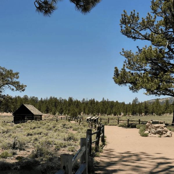
Big Bear Side (East): Dispersed camping and improved camping available. Improved campgrounds: Crab Flats Campground (at trail end), Holcomb Valley Campground, Serrano Campground (near lake), Hanna Flats Campground (north of Fawnskin).
Lake Arrowhead Side (West): North Shore Campground (paid).
Lake Arrowhead offers full services on the western side. Big Bear provides everything you need on the eastern side.
Download offline maps before you go. OnX Offroad, Gaia GPS, and the Forest Service MVUM all show Dishpan Springs and the Willow Creek Jeep Trail section.
Contact the local Ranger Station at San Bernardino National Forest (909) 382-2790 to check on current trail conditions before heading out to Dishpan Springs Trail. Inclement weather conditions can render certain sections impassable, particularly the Deep Creek crossings.
An Adventure Pass may be required for vehicles using the forest for recreation purposes.
Pack out everything. Don't stack rocks to make obstacles easier. Give struggling rigs space. Uphill traffic has the right of way.
Walk the waterfall before driving it. Study the lines. This isn't the place to just point and shoot on Dishpan Springs.
Bring multiple spotters. Different angles help you find the right line.
Check your rig before starting. Tire pressure, fluid levels, and recovery gear accessible. A thorough check can save your day.
Start early. If something breaks, you want daylight for repairs on this trail.
Don't let ego push you into a situation your rig or skills can't handle. Many capable rigs winch the waterfall.
Take photos and videos. The waterfall makes for impressive footage that shows what your build can handle.
Dishpan Springs isn't about the destination. It's about proving your rig and your skills against one of Southern California's most notorious obstacles. The waterfall will test everything you've built and everything you've learned about off-road driving.
But here's the thing: it's achievable. People run Dishpan Springs successfully every weekend during the season with properly built rigs. The key is going in properly prepared with the right gear, the right vehicle setup, and realistic expectations about what you're attempting.
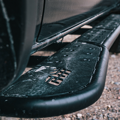
Before you tackle Dishpan Springs, make sure your rig is ready. At Truck Brigade, we build rigs specifically for trails like this. We've got suspension systems by King, Icon, and Fox, full armor packages including sliders, skids, and bumpers. and winch installations and recovery equipment.
Visit truckbrigade.com to get your vehicle built for Dishpan Springs and tackle Southern California's toughest challenges and beyond.
Comments will be approved before showing up.