Your Cart is Empty


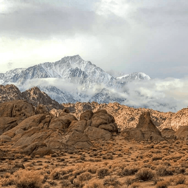
The first time I attended King of Hammers in 2016 watching built rigs tackle Jackhammer and Chocolate Thunder, I understood why Johnson Valley earned its reputation. Located in San Bernardino County between Yucca Valley and Lucerne Valley in Southern California, Johnson Valley has become the famous home of King of the Hammers, a multi-week off-road festival culminating in what is considered the world's toughest single-day off-road race.
Johnson Valley offers incredible terrain variety through the Johnson Valley OHV Area managed by the Bureau of Land Management. You'll find smooth dry lake beds alongside gnarly boulder-strewn canyons separating capable rigs from those getting winched out. The area's signature Hammer trails, including Sledgehammer, Jackhammer, and Claw Hammer, have become bucket-list destinations for off-roaders worldwide.
The landscape combines the wide-open Mojave Desert with technical granite rock formations and rolling hills. Means Dry Lake serves as the main staging area, transforming into a massive off-road festival during King of the Hammers each February. The rest of the year, Johnson Valley provides relatively uncrowded wheeling with trails ranging from stock-vehicle friendly to competition-rig only.
Looking for Other Southern California Off-Road Trails? Check out our So-Cal Off-Road Trail Guide
The Johnson Valley OHV area totals approximately 188,000 acres, but it is critical for visitors to understand how this land is managed and partitioned:
Exclusive Use Recreation Area (~53,000 acres): This section is dedicated solely to public recreation and remains open year-round. It contains many of the most popular destinations, including Means Dry Lake and the legendary Hammer trails.
Shared Use Area (~135,000 acres): This larger section is shared with the Marine Corps Air Ground Combat Center for military training. Public access is permitted here, but this portion is subject to temporary closures. These training exercises are scheduled in advance and the areas are clearly marked when closed.
Every rider bears the personal and legal responsibility to stay within public land boundaries and obey all posted signs. Trespassing onto an active military installation is a serious federal offense. Before exploring, always confirm the latest closure information by contacting theBureau of Land Management (BLM) Barstow Field Office. This shared arrangement allows for continued public recreation while supporting vital military operational needs, and it works successfully when everyone respects the boundaries.
Our trail difficulty system reflects both technical challenges and vehicle requirements to help you choose appropriate routes for your rig and skill level:
Easy Trails: Stock high clearance vehicle recommended. Basic 4WD is helpful but not always required. Wide routes with mild obstacles, good for family weekend trips and scenic route exploration.
Moderate Trails: 4WD required with all-terrain tires. Technical sections require careful line choice. While stock vehicles can complete most of all of the trail with experienced drivers, it is recommended to have an upgraded rig.
Hard Trails: Built rigs are essential. Large tires, lockers, armor, and recovery gear required. Sustained technical challenges with potential for vehicle damage. Advanced driving experience necessary.
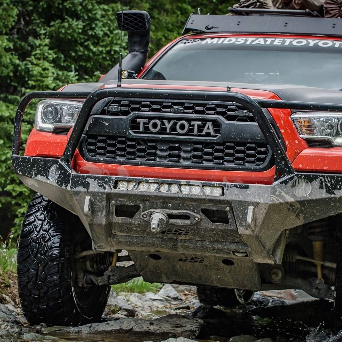
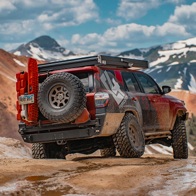
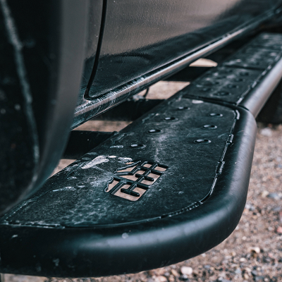
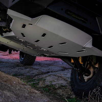
Rock Crawling Preparation: Rocks are some of the most common terrain you will come into contact with at Johnson Valley. Larger tires (ideally 35s for most trails, 37-40s for the most advanced trails) provide clearance over massive boulders. Lockers are non-negotiable. Rock sliders must support the full vehicle weight. Full skid protection covers everything underneath.
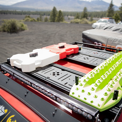
Required Gear: Winch with synthetic line, multiple recovery points, soft shackles, and snatch blocks. Hi-lift jack and recovery boards. Many trails require multiple vehicles working together.
Tire Pressure: Air down significantly to 8-12 PSI depending on setup. Beadlock wheels are also a good idea and can prevent tires from coming off rims at low pressure.
Best Season: October through April offers optimal weather. King of the Hammers typically happens the first week of February when access to some trails is restricted and the area is extremely crowded.
Summer Warning: May through September is hot with temperatures exceeding 110°F. The exposed desert offers virtually no shade. Start at dawn if you visit during the summer months.
Services: Lucerne Valley (west) and Yucca Valley (south) offer gas, food, and supplies. Johnson Valley itself has no services. Cell service is spotty.
|
Trail |
Difficulty |
Miles |
Time |
Highlights |
Best Season |
Suggested Rig |
|
Hammers Scenic Byway |
Easy |
~22 |
2-3 hrs |
Desert views, connects canyons |
Fall-Spring |
Stock 4WD/SUV |
|
Means Dry Lake & Road to the Hammers |
Easy |
~10 |
1-2 hrs |
Main event area |
Fall-Spring |
Stock 4WD/SUV |
|
Anderson Dry Lake Area |
Easy |
~18 |
2-3 hrs |
Open desert |
Fall-Spring |
Stock 4WD/SUV |
|
Turkey Claw |
Moderate |
~1.5 |
1-2 hrs |
Steep climb, ledges |
Fall-Spring |
33-35"+ tires |
|
Fissure Mountain |
Moderate |
~4 |
2-4 hrs |
Ridge climbs, rock shelves |
Fall-Spring |
35"+ tires |
|
Aftershock |
Hard |
~3 |
2-4 hrs |
Waterfall obstacles |
Winter-Spring |
37"+ tires, winch |
|
Sledgehammer |
Hard |
~2 |
2-4 hrs |
Original Hammer, huge boulders |
Winter-Spring |
37"+ tires, lockers |
|
Jackhammer |
Hard |
~2 |
3-5 hrs |
Vertical ledges, toughest |
Winter-Spring |
40"+ tires, comp rigs |
|
Wrecking Ball |
Hard |
~2 |
2-4 hrs |
Boulder gardens |
Winter-Spring |
37"+ tires, lockers |
|
Chocolate Thunder |
Hard |
~1.5 |
1-2 hrs |
Iconic KOH obstacle |
Fall-Spring |
35"+ tires, lockers |
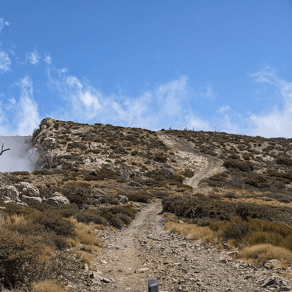
Hammers Scenic Byway provides a perfect introduction to Johnson Valley off-road trails without technical challenges. This 22-mile route connects major canyon areas through open valley terrain accessible to stock highway vehicles and high-clearance SUVs. The byway follows established dirt roads showcasing the landscape with views of steep red rocky mountains in the distance.
You'll drive through classic Mojave Desert scenery with Joshua trees, granite rock outcroppings, and rolling hills. Multiple pullouts let you watch built rigs tackling nearby technical trails. Plan 2-3 hours at relaxed pace. The byway is popular during King of the Hammers week as spectators use it to access viewing areas.
Means Dry Lake serves as Johnson Valley's main staging area, especially during King of the Hammers. This easy dry lake bed connects with roads leading toward the Hammer trails. The hard-packed dry lake surface allows for higher speeds and provides excellent photography opportunities.
Road to the Hammers connects Means Dry Lake to canyon entrances, featuring sandy washes and moderate washboard sections. Stock 4WD vehicles handle this easily. This area gets extremely crowded during the famous King of the Hammers event but offers solitude rest of the year. Many off roaders camp near Means Dry Lake for easy access to trails.
Be aware that with rain this area can become very saturated with water and it is not advised to camp near if rain is in the forecast.

Anderson Dry Lake provides another dry lake bed experience with access to various trails. The area features more open terrain perfect for fast-paced desert riding when conditions are dry. Multiple trails branch through the area, all suitable for stock vehicles on public land managed by BLM.
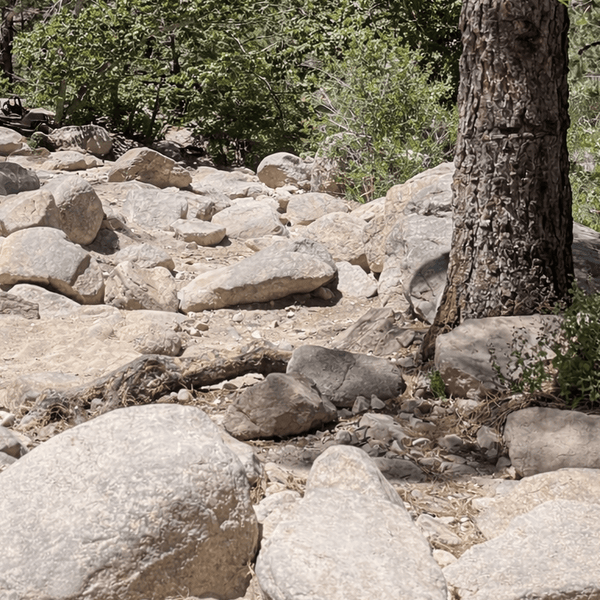
Turkey Claw offers the most accessible taste of Johnson Valley's technical terrain. This short 1.5-mile trail features steep climbs with ledges testing approach angles and requiring line selection. The trail got its name from the three-pronged route at the top.
Minimum 33-inch tires recommended, though 35s are better. The rock ledges provide excellent skill level building opportunities. It is not uncommon for off-roaders to run Turkey Claw as warm-up before attempting harder trails in the Johnson Valley OHV area.

Fissure Mountain extends the challenge over 4 miles with ridge climbs through rolling hills, rock shelves, and moderate boulder sections. This trail demands sustained technical driving while remaining accessible to well-built vehicles with 35-inch tires and skid plates. The ridge sections offer spectacular views across Johnson Valley shared use area.
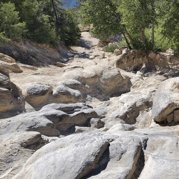
Johnson Valley's fame rests on the Hammer trails, granite boulder-strewn canyons that became legendary during King of the Hammers. These trails formed the rock crawling portion of the race course, testing the world's best Ultra4 drivers. For recreational off-roaders, they represent the pinnacle of technical challenge in California.

The original Hammer trail features massive granite rock requiring precise wheel placement, winch-assisted climbs, and constant spotting. The 2-mile route can take 2-4 hours with huge boulder gardens and steep climbs over ledges taller than most vehicles. Minimum 37-inch tires, lockers, full armor, and a winch required.
Widely considered Johnson Valley's toughest trail and possibly the world's most difficult recreational rock crawling route. The narrow canyon features near-vertical ledges and obstacles that stop all but the most capable rigs. Most successful runs involve 40+ inch tires and competition-level modifications. Expect 3-5 hours for 2 miles with extensive winching. Only attempt with a highly experienced group.
This tight technical canyon combines steep rock ledges with narrow passages. The 2-mile route features sustained difficulty without Jackhammer's extreme vertical challenges. Minimum 35-inch tires with lockers required. The canyon walls create dramatic scenery while limiting escape routes.
Known for waterfall-like obstacles where vehicles climb near-vertical granite faces. The trail features multiple "waterfall" climbs requiring momentum and often winch support. Minimum 37-inch tires with a winch essential.
This trail has become iconic as a King of the Hammers spectator area, featuring steep rock ledges and challenging climbs. All Hammer trails require advance preparation, proper safety gear, and realistic assessment of your skill level.

Scenic Introduction: Hammers Scenic Byway with stops at canyon entrances, Means Dry Lake exploration, Anderson Dry Lake for photography. This provides excellent Johnson Valley overview without technical driving.
Moderate Challenge: Turkey Claw morning session followed by Fissure Mountain afternoon. This progression builds skills and tests vehicle capability.
Advanced Test: Sledgehammer or Claw Hammer as full-day commitment. Plan 4-6 hours with proper recovery equipment and experienced group.
Weekend Skills Builder: Day 1: Scenic byway scouting, Turkey Claw afternoon. Camp near Means Dry Lake on public land. Day 2: Fissure Mountain with possible Turkey Claw repeat if time allows.
Hammer Challenge Weekend: Day 1: Warmup on Turkey Claw, then tackle Claw Hammer or Chocolate Thunder. Day 2: Sledgehammer if rigs are prepared and group is confident. Built rigs and experienced drivers required.
King of the Hammers Spectator Trip: Visit during the famous event in early February for the ultimate Johnson Valley experience. Watch the race, explore spectator areas, and experience the massive off-road festival. Book camping well in advance, as the Johnson Valley shared-use area fills completely. Be aware that some trails may be restricted during the event.
From I‑15 at Barstow, take exit to CA‑18/CA‑247 and follow CA‑247 (Old Woman Springs Road) southeast about 55 miles. Then turn north or northeast onto one of the dirt access roads (such as Camp Rock Road, Bessemer Mine Road or Boone Road) to enter the Johnson Valley OHV area.
From I-15 at Victorville, Take Interstate 15 to Bear Valley Road (Exit 147) and head east toward Lucerne Valley. Continue on Bear Valley Road for approximately 20 miles until it intersects with Highway 247 (Barstow Road). Turn north on Highway 247, and after about 10 miles, turn east onto Boone Road. Boone Road leads directly into the main Johnson Valley OHV Area and is the most commonly used access point, especially during major events like King of the Hammers.
If coming from the Yucca Valley / Morongo Basin region, you can head toward the 247 corridor and then north into the OHV area — but check maps and signs carefully for private land and restricted zones.
Navigation: Download offline map information before arrival using onX Offroad, Gaia GPS, or Avenza. Cell service is unreliable throughout Johnson Valley so plan accordingly. GPS coordinates for trail entrances are essential. Be aware of base boundaries and posted signs indicating military training areas.
Camping: Dispersed camping is allowed on public land throughout the Johnson Valley OHV area year round. Popular areas include zones near Means Dry Lake. Camp on previously disturbed sites. No amenities exist in the field. Avoid camping near base boundaries or in areas with posted signs restricting access. Also you might not want to park close to trail entrances or other well-traveled routes to limit dust exposure.
Permits: No permits required for day use or dispersed camping outside the King of the Hammers event period. During the event, special regulations apply in some restricted areas.
Fuel and Supplies: Fill up in Lucerne Valley or Yucca Valley before heading into Johnson Valley. No services exist in the area. Bring all food, water, and supplies needed. Plan accordingly, as nearest support is 20+ miles away.
Respect Boundaries: As a Johnson Valley share-use area with military training operations, respecting boundaries is critical. Posted signs mark base boundaries and restricted areas. Avoid trespassing on Marine Corps installation land or private property. This is your personal and legal responsibility as an OHV user.
Check Before You Ride: Contact the BLM Barstow Field Office for current information on area closures related to military training. Some sections may be temporarily restricted when training exercises are active. Airspace restrictions may also apply in certain areas.
Stay Informed: The Johnson Valley shared use arrangement between public recreation and military training requires awareness from all OHV users. Many off roaders support this shared model by practicing responsible recreation and respecting posted signs.
Stay on Established Routes: Stick to established trails visible on maps. Desert vegetation and soil crusts recover slowly from damage. Don't create new tracks through pristine desert.
Minimize Impact: Use established dispersed campsites on durable surfaces near dry lake beds. Pack out all trash. Johnson Valley unfortunately, sees significant litter problems; set good example.
Technical Trail Etiquette: On narrow rock trails, uphill traffic has priority. Use proper radio contact when multiple groups share trails. Communicate courteously even during difficult sections.
Winch Safety: Everyone not directly involved should stay outside danger zones. Use proper technique to create safe recovery situations.
Johnson Valley off road trails represent the pinnacle of California rock crawling, home to legendary Hammer trails that test the world's best drivers during King of the Hammers. Whether exploring scenic routes around Means Dry Lake or attempting the infamous Jackhammer, understanding the Johnson Valley shared use area, respecting base boundaries, and taking personal and legal responsibility ensures continued public access to this world-famous destination. With proper vehicle preparation and advance planning, Johnson Valley delivers unforgettable desert adventures year round.
Comments will be approved before showing up.