Your Cart is Empty


The first time I took the Gold Mountain Trail, I had a buddy who swore his stock 4Runner could handle anything. Twenty minutes later, we're spotting him through a rock garden with his front tire hanging in the air and his rear diff kissing granite. Gold Mountain doesn't mess around. It looks easy on a map, but this mountain trail's been teaching people lessons since the first time it was run decades ago.
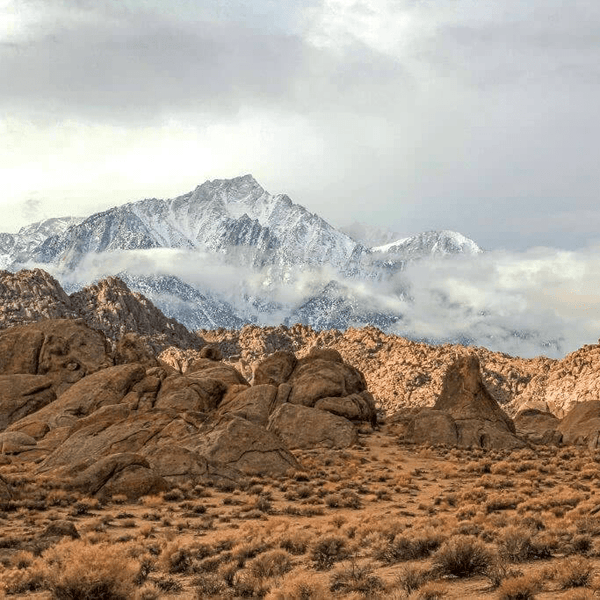
You'll find Gold Mountain on the eastern edge of the Big Bear Valley, climbing from about 6,700 feet to the summit at 8,235 feet in elevation. The technical trail (3N69) runs approximately 4.5 miles, connecting the north shore of Baldwin Lake to the high country of Holcomb Valley.
Looking for other Big Bear trails? Check out our Big Bear Off-Road Trail Guide
Picture pine forests mixed with granite and rocky terrain that's going to test every angle of your rig. You can tackle it solo, link it with Holcomb Valley, or make it part of a bigger Big Bear loop. This is one adventure that demands the right vehicle capability, and this is everything you need to know about it.
The Gold Mountain Trail (also known as Forest Service Road 3N69) follows old mining and logging routes from Big Bear's 1860s gold rush days. This isn't a tourist road, it is for serious off-roaders only.
While technically open year-round (unless closed by a specific Forest Service order due to fire or heavy snow), most people plan to run it between late spring and fall. May or June is when the worst of the deep snowmelt usually clears. Come November and into December, early snow and winter conditions turn those sketchy sections into proper hazards.
What you're signing up for is 4.5 miles of distance that swings from moderate (3/10 difficulty) to challenging and difficult (7+/10) depending on what Mother Nature's been doing. The steep sections and elevation change total about 1,500 feet. Yes, it doesn't sound like much until you're crawling over massive rocks at half a mile per hour.
You've got three ways to reach the area, but the start of the trail is at the eastern end of the valley near Baldwin Lake.
Most people start here to run the trail "uphill." Take Highway 18 out of Lucerne Valley up to the east side of Big Bear specifically Baldwin Lake. As you come up to the top of the mountain you will continue on Highway 18 past Holcomb Valley Road around Baldwin Lake (often without water in some seasons). Forest Road 3N69 will be on your right side. If you make it to the first set of homes, you have gone too far.
Coming up from Orange County, LA County, or the Inland Empire? Highway 330 through Running Springs can be the most direct way but make sure you check the traffic. Weekends and holiday traffic can turn a 1.5 hour drive into a 4 hour crawl. After getting to Running Springs, stop for a sandwich at Rocky’s Deli and continue past Snow Valley Ski Resort toward Big Bear. Once you hit the Big Bear dam you can either continue straight toward the city of Big Bear or turn left toward Fawnskin. The latter is the most efficient way but has limited resources so if you need food, fuel or something else, go through Big Bear proper.
If you elect to go through the city, continue through town. You will want to turn left on Stanfield Cutoff or Division Drive to get on Highway 18 or Northshore Drive. Turn right and head to the Baldwin Lake area. Once you start to see no more houses on the left side the start of the trail will be on the left side. If you are coming through Fawnskin you will already be on Northshore Drive and will continue the trail on the left side. If you make it to Holcomb Valley Road you have gone too far.
The eastern route via Highway 38 from Redlands takes you past Angelus Oaks and over Onyx Summit. You'll drop right into the Baldwin Lake area. This takes a bit longer unless you are based in Redlands or in that area but the San Gorgonio Wilderness views are killer. I will also note this is the preferred way for many if there is traffic or more popular routes. I personally like this route the best. The views are great and it is usually less traveled. You also bypass all the Big Bear traffic, but make sure you stock up with what you need so you don't have to backtrack into town.
As you climb to Onyx Summit you will start to drop down into the Big Bear Valley and eventually Big Bear City. You will come to your first stop sign where you can either go right around Baldwin Lake or go left. If you go left you will then need to take a right on Greenway and then another right on Highway 18 (North Short Drive). The trail will then be on your left. If you take a right at the first stop sign you will follow Baldwin Lake around until you reach Highway 18 (North Shore Drive). Turn left and the trailhead will be on your right a few miles down.
Gold Mountain Road starts with a bang. Unlike some trails that "build up," the most technical rocky sections hit you within the first mile and a half. That first few hundred yards? Just dirt with some ruts. Then you climb into the pines and reality hits. The way forward gets steeper and more technical.
Figure on 2 to 3 hours if you know what you're doing and it's dry. First timer? Add an hour. Rain or snowmelt? Tack on more time and bump the expected difficulty up two notches minimum.
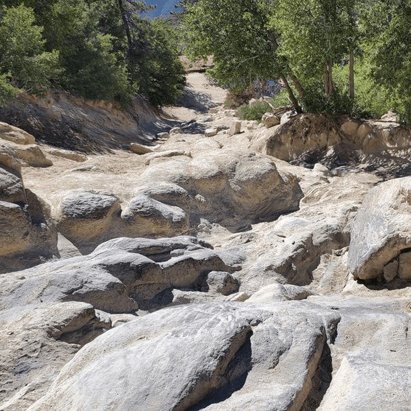
The surface changes constantly. Decomposed granite one minute, exposed bedrock the next, then boulder fields that make you question your line choice. We also cannot forget the waterfalls which can be blamed for many rigs not making it or breaking. You're always thinking three moves ahead about where your wheels need to be. What works for 33s might not work for 35s. Breakover angle matters big time. You'll see plenty of evidence where other rigs learned that lesson the hard way.

Trail width is all over the place. Sometimes it's a comfortable two-track. Other times, you are forced to funnel into a specific area because it is just too gnarly. The woods can feel tight in spots. Needless to say, if you're feeling precious about your rig's finish, maybe sit this one out.
Straight shot. Start at the Highway 18 / Baldwin Lake trailhead, run 3N69 North to where it connects with 3N16 in Holcomb Valley. Round-trip takes 3 to 4 hours of time if you're doing an out-and-back.
Who it's for: First-timers wanting to focus on this specific trail. Beginners who want to test their builds without committing to an all-day thing. You can bail at any point if things go sideways.
This is how I prefer to run it. Run Gold Mountain (3N69) south-to-north, then spend the afternoon exploring Holcomb Valley (which is scenic and historic). You get variety. Gold Mountain gives you the technical challenge, then Holcomb Valley provides a relaxing scenic drive through the forest road network.
The connector from Gold Mountain to the heart of Holcomb runs about 6 miles of moderate terrain. Good setup if you're camping at Holcomb for the weekend. Wake up, have coffee, then hit Gold Mountain fresh. It's the perfect way to enjoy the area.
Who it's for: Intermediate to advanced drivers who want a longer day and aren't scared of variety. Plan on 5 to 7 hours, depending on how many photo stops you make.
|
Section |
Description |
Notes |
|
Rocky Trail Section with Boulders |
Most of the trail |
Slow, controlled driving with careful line choices is recommended. |
|
First Waterfall |
Steep rock feature |
Take this in a low gear and have a spotter help direct you to the best line. |
|
Second Waterfall |
A steeper rock feature |
Considered the toughest obstacle on the trail. Steeper than the first with multiple lines. Air down and use a spotter. |
|
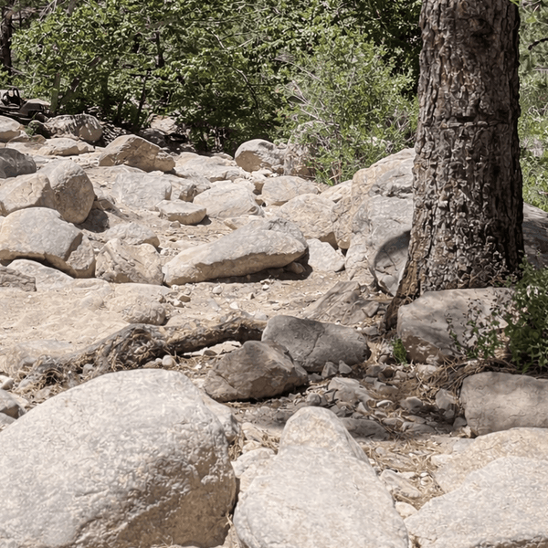
Bone Yard/Rock Garden |
Field of scattered rocks(medium to large) |
Select the most optimal line and take your time. |
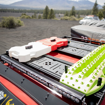
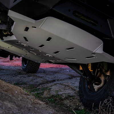
After running Gold Mountain a dozen times and watching dozens more try it, here's the bare minimum for vehicles attempting this trail:
That gets you through on a good day with careful driving. I've done it with a fairly basic setup on 33s with just sliders and skids. But I had to be super deliberate about every line, and I definitely hit some rocks. I wouldn't recommend a beginner doing it with such a simple setup.
If you're building specifically for trails like this, here's what makes life easier and more complete:
This setup turns Gold Mountain from white-knuckle to genuinely fun technical trail. The lockers especially. Once you have them, you wonder how you ever ran trails without them. Higher clearance vehicles definitely have an advantage here.
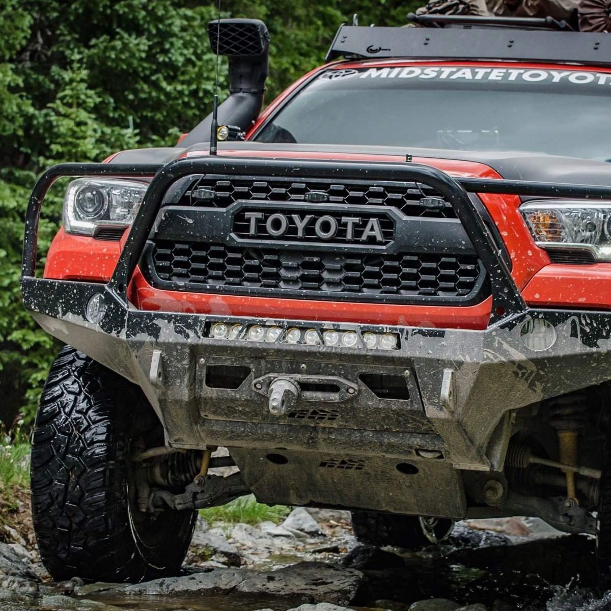
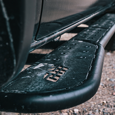
One thing I always tell people: don't cheap out on sliders. I've watched bargain bolt-on nerf bars fold like tinfoil against granite. Quality sliders from companies like RCI Offroad or CBI Offroad bolt to your frame and actually protect your rocker panels. Pro tip - they can also act as a great jacking point for a Hi-Lift. They're a significant investment, but body work is not only potentially more expensive, but it's also more frustrating to spend on.
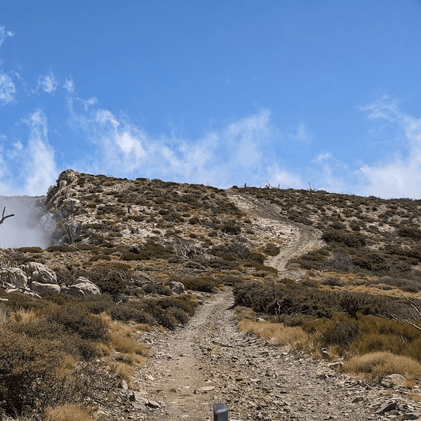
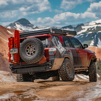
Near the summit (mile 3.5-4), there's a rocky outcrop that serves as a natural viewpoint. The views across Holcomb Valley toward the main Big Bear Lake are worth the visit. On clear days, you can spot landmarks all the way to San Gorgonio. While the summit itself is 8,235 feet, these viewpoints are where you'll want to stop and learn about the area's mining history.

Old mine tailings scattered along the route remind you that people were working these mountains with pickaxes and mules 150 years ago. Black bears are in the area. Standard bear country rules apply: secure food at camp, don't leave trash.
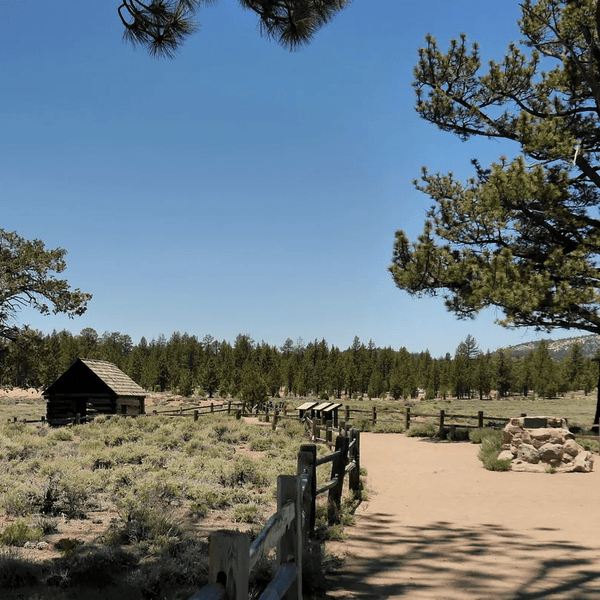
Dispersed camping is legal throughout the San Bernardino National Forest. Stay 200 feet from any water sources, pack out everything, and use existing fire rings (check fire restrictions). Holcomb Valley has several established dispersed camping sites that work great as base camps for enjoying the area.
Prefer developed camping? Big Bear has multiple Forest Service campgrounds within 20 minutes of the trailhead if you're planning to stay overnight. The area also sees mountain bikers and hikers. Be cool and yield to non-motorized users. Many people travel here specifically for the multi-use recreation opportunities.
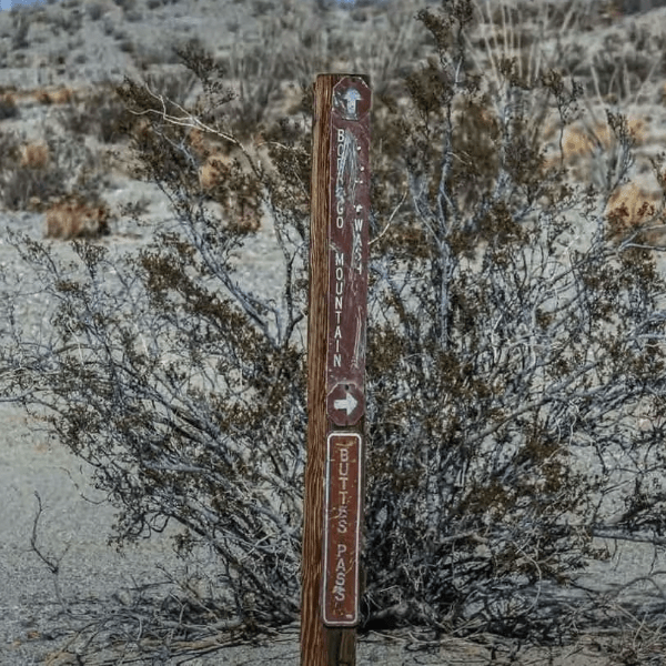
The San Bernardino National Forest motor vehicle use map (MVUM) shows all legal routes, including Gold Mountain Trail (3N69). Download it from the Forest Service website or grab a physical copy at Big Bear Discovery Center.
Gaia GPS and OnX Offroad both have solid mapping for this area. If you use the Gaia GPS app, make sure to download offline maps before you head out since cell service is spotty. These apps create detailed trail logs and let you add waypoints for photos or obstacles you'll want to remember on the way back.
Trail conditions: Check the San Bernardino National Forest website or call Big Bear Discovery Center at (909) 382-2790 for current conditions and closures. The right intel makes all the difference.
Gold Mountain Trail isn't for everyone. That's what makes it special. It demands respect, preparation, and an honest assessment of what your rig can do. But if you're after that next-level technical challenge in Southern California, this is one of the best.
Before you head out, ensure your build is actually ready for this trail. Whether you need the rock sliders that save your body panels or a set of lockers to turn those "maybe" climbs into "probably" ones, Truck Brigade is your go-to source. We specialize in high-quality overlanding and off-road gear specifically designed for these kinds of challenges.
Download Gaia GPS or another trail app before you head out, grab your recovery gear, and you'll be ready to navigate Gold Mountain with confidence. We'll see you on the rocks.
Comments will be approved before showing up.